Fāryāb geodata
Fāryāb (Kerman) is a seat of a second-order administrative division; located in Iran in Asia/Tehran (GMT+3.5) time zone. In our database, there are 232 cities with bigger population. Compared to other cities in Iran, 92.3% of cities are located further ↑North; 84.8% of cities are located further ←West and 70.7% of cities have higher elevation than Fāryāb. Note1


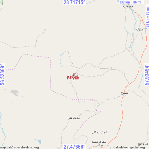
Fāryāb GPS coordinates[2]
28° 5' 55.32" North, 57° 13' 54.516" East
| Map corner | latitude | longitude |
|---|---|---|
| Upper-left | 28.71715°, | 56.52869° |
| Center: | 28.0987°, | 57.23181° |
| Lower-right: | 27.47666°, | 57.93494° |
| Map W x H: | 137.9×137.9 km | = 85.7×85.7mi |
| max Lat: | 39.6482° ⇑92.3% North |
| Fāryāb: | 28.0987° |
| min Lat: | ⇓7.7% South 25.2919° |
| min Long | Fāryāb | max Long |
| 44.38416° | 57.23181° | 61.9965° |
| W 84.8%⇐ | ⇒15.2% E |
Elevation
Elevation of Fāryāb is 660 m = 2165 ft, and this is 389 m = 1276 ft below average elevation for this country.
| Max E: |
2564 m = 8412 ft | 70.7% |
| Avg. | 1049 m = 3442 ft | |
| Fāryāb | 660 m = 2165 ft | |
Min E: |
-24 m = -79 ft | 29.3% |
See also: Iran elevation on elevation.city.
Geographical zone
Fāryāb is located in North temperate zone (between Tropic of Cancer and the Arctic Circle). Distance of this Northern Tropic circle is 518.4 km =322.1 mi to South.| Distance of | km | miles | from Fāryāb |
|---|---|---|---|
| North Pole | 6882.8 | 4276.8 | to North |
| Arctic Circle | 4276.9 | 2657.5 | to North |
| Tropic Cancer | 518.4 | 322.1 | to South |
| Equator | 3124.3 | 1941.3 | to South |


Nearby cities:
15 places around Fāryāb: (largest is in red/bold)
• Arzū’īyeh
92.3 km =57.4 mi,  294°
294°
• Bam
156.9 km =97.5 mi,  44°
44°
• Bandar Abbas
138.1 km =85.8 mi,  222°
222°
• Bāft
140.3 km =87.2 mi,  334°
334°
• Eslāmābād
75.8 km =47.1 mi,  96°
96°
• Jīroft
81.4 km =50.6 mi, 37°
• Kahnūj
48.7 km =30.3 mi,  109°
109°
• Kūh Sefīd
137.5 km =85.4 mi,  342°
342°
• Manūjān
81.4 km =50.6 mi,  160°
160°
• Mīnāb
108.5 km =67.4 mi,  187°
187°
• Qal‘eh Ganj
90.4 km =56.2 mi,  135°
135°
• Rābor
136.2 km =84.6 mi,  346°
346°
• Rūdān
73.1 km =45.4 mi,  183°
183°
• Ḩājjīābād
132.4 km =82.3 mi,  280°
280°
• ‘Anbarābād
73.5 km =45.7 mi,  55°
55°
Sources, notices
• [Note1] Compared only with cities in Iran existing in our database
• [Src1] Map data: © OpenStreetMap contributors (CC-BY-SA)
• [Src2] Other city data from geonames.org with taken over terms of usage.
• [Src3] Geographical zone / Annual Mean Temperature by Robert A. Rohde @ Wikipedia
