Qal‘eh Ganj geodata
Qal‘eh Ganj (Kerman) is a seat of a second-order administrative division; located in Iran in Asia/Tehran (GMT+3.5) time zone. In our database, there are 232 cities with bigger population. Compared to other cities in Iran, 94.6% of cities are located further ↑North; 87.3% of cities are located further ←West and 75.1% of cities have higher elevation than Qal‘eh Ganj. Note1


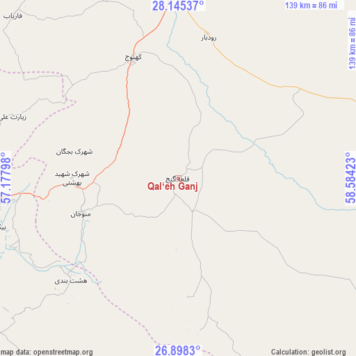
Qal‘eh Ganj GPS coordinates[2]
27° 31' 24.96" North, 57° 52' 51.96" East
| Map corner | latitude | longitude |
|---|---|---|
| Upper-left | 28.14537°, | 57.17798° |
| Center: | 27.5236°, | 57.8811° |
| Lower-right: | 26.8983°, | 58.58423° |
| Map W x H: | 138.7×138.7 km | = 86.2×86.2mi |
| max Lat: | 39.6482° ⇑94.6% North |
| Qal‘eh Ganj: | 27.5236° |
| min Lat: | ⇓5.4% South 25.2919° |
| min Long | Qal‘eh Ganj | max Long |
| 44.38416° | 57.8811° | 61.9965° |
| W 87.3%⇐ | ⇒12.7% E |
Elevation
Elevation of Qal‘eh Ganj is 406 m = 1332 ft, and this is 643 m = 2110 ft below average elevation for this country.
| Max E: |
2564 m = 8412 ft | 75.1% |
| Avg. | 1049 m = 3442 ft | |
| Qal‘eh Ganj | 406 m = 1332 ft | |
Min E: |
-24 m = -79 ft | 24.9% |
See also: Iran elevation on elevation.city.
Geographical zone
Qal‘eh Ganj is located in North temperate zone (between Tropic of Cancer and the Arctic Circle). Distance of this Northern Tropic circle is 454.4 km =282.4 mi to South.| Distance of | km | miles | from Qal‘eh Ganj |
|---|---|---|---|
| North Pole | 6946.7 | 4316.5 | to North |
| Arctic Circle | 4340.8 | 2697.2 | to North |
| Tropic Cancer | 454.4 | 282.4 | to South |
| Equator | 3060.3 | 1901.6 | to South |


Nearby cities:
15 places around Qal‘eh Ganj: (largest is in red/bold)
• Arzū’īyeh
179.9 km =111.8 mi,  304°
304°
• Bandar Abbas
162.4 km =100.9 mi,  256°
256°
• Dalgān
154.5 km =96 mi,  91°
91°
• Eslāmābād
57.1 km =35.5 mi,  11°
11°
• Fāryāb
90.4 km =56.2 mi,  315°
315°
• Jīroft
129.1 km =80.2 mi,  353°
353°
• Kahnūj
50.9 km =31.6 mi,  339°
339°
• Manūjān
39.7 km =24.7 mi,  250°
250°
• Moḩammadābād
172.9 km =107.4 mi,  42°
42°
• Mīnāb
89.8 km =55.8 mi,  240°
240°
• Narmāshīr
177.8 km =110.5 mi,  26°
26°
• Qeshm
171.7 km =106.7 mi, 248°
• Rūdān
68.6 km =42.6 mi, 262°
• Sardasht
118.7 km =73.8 mi,  178°
178°
• ‘Anbarābād
105.9 km =65.8 mi,  358°
358°
Sources, notices
• [Note1] Compared only with cities in Iran existing in our database
• [Src1] Map data: © OpenStreetMap contributors (CC-BY-SA)
• [Src2] Other city data from geonames.org with taken over terms of usage.
• [Src3] Geographical zone / Annual Mean Temperature by Robert A. Rohde @ Wikipedia
