Noşratābād geodata
Noşratābād (Sistan and Baluchestan) is a populated place; located in Iran in Asia/Tehran (GMT+3.5) time zone. With population of 4,182 people, there are 216 cities with bigger population in this country. Compared to other cities in Iran, 83.9% of cities are located further ↑North; 95.5% of cities are located further ←West and 53.1% of cities have higher elevation than Noşratābād. Note1


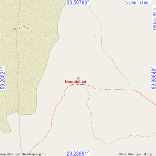
Noşratābād GPS coordinates[2]
29° 54' 0" North, 59° 58' 59.988" East
| Map corner | latitude | longitude |
|---|---|---|
| Upper-left | 30.50766°, | 59.28021° |
| Center: | 29.9°, | 59.98333° |
| Lower-right: | 29.28861°, | 60.68646° |
| Map W x H: | 135.5×135.5 km | = 84.2×84.2mi |
| max Lat: | 39.6482° ⇑83.9% North |
| Noşratābād: | 29.9° |
| min Lat: | ⇓16.1% South 25.2919° |
| min Long | Noşratābād | max Long |
| 44.38416° | 59.98333° | 61.9965° |
| W 95.5%⇐ | ⇒4.5% E |
Elevation
Elevation of Noşratābād is 1112 m = 3648 ft, and this is 63 m = 207 ft above average elevation for this country.
| Max E: |
2564 m = 8412 ft | 53.1% |
| Noşratābād | 1112 m 3648 ft | |
| Avg. | 1049 m = 3442 ft | |
Min E: |
-24 m = -79 ft | 46.9% |
See also: Iran elevation on elevation.city.
Geographical zone
Noşratābād is located in North temperate zone (between Tropic of Cancer and the Arctic Circle). Distance of this Northern Tropic circle is 718.6 km =446.5 mi to South.| Distance of | km | miles | from Noşratābād |
|---|---|---|---|
| North Pole | 6682.5 | 4152.3 | to North |
| Arctic Circle | 4076.6 | 2533.1 | to North |
| Tropic Cancer | 718.6 | 446.5 | to South |
| Equator | 3324.6 | 2065.8 | to South |


Nearby cities:
15 places around Noşratābād: (largest is in red/bold)
• Bam
180.5 km =112.2 mi,  240°
240°
• Dalgān
273.9 km =170.2 mi,  191°
191°
• Dūst Moḩammad Khān
221.8 km =137.8 mi,  51°
51°
• Eslāmābād
284 km =176.5 mi,  222°
222°
• Fahraj
149.9 km =93.1 mi,  225°
225°
• Jīroft
256.4 km =159.3 mi, 238°
• Kerman
282.6 km =175.6 mi,  278°
278°
• Khāsh
221.8 km =137.8 mi,  147°
147°
• Moḩammadābād
162.9 km =101.2 mi,  212°
212°
• Narmāshīr
163.1 km =101.3 mi, 229°
• Nehbandān
182.6 km =113.5 mi,  1°
1°
• Zahedan
96.1 km =59.7 mi,  117°
117°
• Zehak
196.7 km =122.2 mi,  55°
55°
• Zābol
191.8 km =119.2 mi, 49°
• ‘Anbarābād
260.8 km =162.1 mi, 232°
Sources, notices
• [Note1] Compared only with cities in Iran existing in our database
• [Src1] Map data: © OpenStreetMap contributors (CC-BY-SA)
• [Src2] Other city data from geonames.org with taken over terms of usage.
• [Src3] Geographical zone / Annual Mean Temperature by Robert A. Rohde @ Wikipedia
