Zahedan geodata
Zahedan (Sistan and Baluchestan) is a seat of a first-order administrative division; located in Iran in Asia/Tehran (GMT+3.5) time zone. With population of 551,980 people, there are 14 cities with bigger population in this country. Compared to other cities in Iran, 85.3% of cities are located further ↑North; 98.2% of cities are located further ←West and 63.7% of cities have lower elevation than Zahedan. Note1


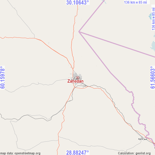
Zahedan GPS coordinates[2]
29° 29' 46.68" North, 60° 51' 46.44" East
| Map corner | latitude | longitude |
|---|---|---|
| Upper-left | 30.10643°, | 60.15978° |
| Center: | 29.4963°, | 60.8629° |
| Lower-right: | 28.88247°, | 61.56603° |
| Map W x H: | 136.1×136.1 km | = 84.6×84.6mi |
| max Lat: | 39.6482° ⇑85.3% North |
| Zahedan: | 29.4963° |
| min Lat: | ⇓14.7% South 25.2919° |
| min Long | Zahedan | max Long |
| 44.38416° | 60.8629° | 61.9965° |
| W 98.2%⇐ | ⇒1.8% E |
Elevation
Elevation of Zahedan is 1380 m = 4528 ft, and this is 331 m = 1086 ft above average elevation for this country.
| Max E: |
2564 m = 8412 ft | 36.3% |
| Zahedan | 1380 m 4528 ft | |
| Avg. | 1049 m = 3442 ft | |
Min E: |
-24 m = -79 ft | 63.7% |
See also: Zahedan elevation on elevation.city.
Geographical zone
Zahedan is located in North temperate zone (between Tropic of Cancer and the Arctic Circle). Distance of this Northern Tropic circle is 673.8 km =418.7 mi to South.| Distance of | km | miles | from Zahedan |
|---|---|---|---|
| North Pole | 6727.4 | 4180.2 | to North |
| Arctic Circle | 4121.5 | 2561 | to North |
| Tropic Cancer | 673.8 | 418.7 | to South |
| Equator | 3279.7 | 2037.9 | to South |


Nearby cities:
15 places around Zahedan: (largest is in red/bold)
• Bam
246.8 km =153.4 mi,  259°
259°
• Dalgān
263.2 km =163.5 mi,  211°
211°
• Dūst Moḩammad Khān
203.8 km =126.6 mi,  25°
25°
• Fahraj
201.3 km =125.1 mi,  252°
252°
• Iranshahr
255.6 km =158.8 mi,  183°
183°
• Khāsh
145.9 km =90.7 mi,  166°
166°
• Moḩammadābād
196.7 km =122.2 mi,  242°
242°
• Narmāshīr
218.6 km =135.8 mi, 253°
• Nehbandān
240.8 km =149.6 mi,  340°
340°
• Noşratābād
96.1 km =59.7 mi,  297°
297°
• Sūrān
269.7 km =167.6 mi,  155°
155°
• Zehak
174.1 km =108.2 mi, 26°
• Zābol
181.1 km =112.5 mi,  19°
19°
• Zābolī
274.7 km =170.7 mi, 163°
• ‘Anbarābād
314.4 km =195.4 mi, 248°
Sources, notices
• [Note1] Compared only with cities in Iran existing in our database
• [Src1] Map data: © OpenStreetMap contributors (CC-BY-SA)
• [Src2] Other city data from geonames.org with taken over terms of usage.
• [Src3] Geographical zone / Annual Mean Temperature by Robert A. Rohde @ Wikipedia
