Mīnāb geodata
Mīnāb (Hormozgan) is a seat of a second-order administrative division; located in Iran in Asia/Tehran (GMT+3.5) time zone. With population of 70,790 people, there are 93 cities with bigger population in this country. Compared to other cities in Iran, 97.1% of cities are located further ↑North; 84.4% of cities are located further ←West and 85.5% of cities have higher elevation than Mīnāb. Note1


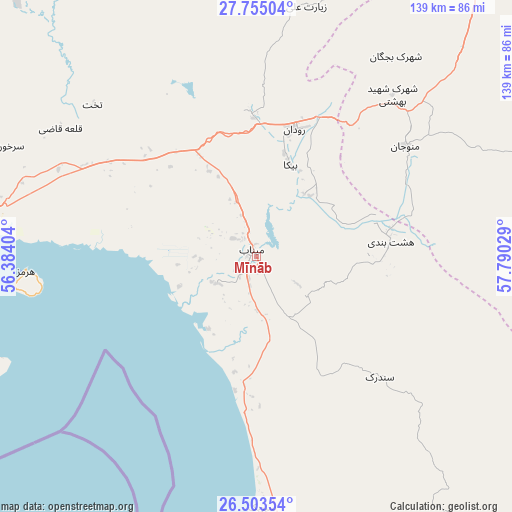
Mīnāb GPS coordinates[2]
27° 7' 51.744" North, 57° 5' 13.776" East
| Map corner | latitude | longitude |
|---|---|---|
| Upper-left | 27.75504°, | 56.38404° |
| Center: | 27.13104°, | 57.08716° |
| Lower-right: | 26.50354°, | 57.79029° |
| Map W x H: | 139.2×139.2 km | = 86.5×86.5mi |
| max Lat: | 39.6482° ⇑97.1% North |
| Mīnāb: | 27.13104° |
| min Lat: | ⇓2.9% South 25.2919° |
| min Long | Mīnāb | max Long |
| 44.38416° | 57.08716° | 61.9965° |
| W 84.4%⇐ | ⇒15.6% E |
Elevation
Elevation of Mīnāb is 43 m = 141 ft, and this is 1006 m = 3301 ft below average elevation for this country.
| Max E: |
2564 m = 8412 ft | 85.5% |
| Avg. | 1049 m = 3442 ft | |
| Mīnāb | 43 m = 141 ft | |
Min E: |
-24 m = -79 ft | 14.5% |
See also: Mīnāb elevation on elevation.city.
Geographical zone
Mīnāb is located in North temperate zone (between Tropic of Cancer and the Arctic Circle). Distance of this Northern Tropic circle is 410.8 km =255.3 mi to South.| Distance of | km | miles | from Mīnāb |
|---|---|---|---|
| North Pole | 6990.4 | 4343.6 | to North |
| Arctic Circle | 4384.5 | 2724.4 | to North |
| Tropic Cancer | 410.8 | 255.3 | to South |
| Equator | 3016.7 | 1874.5 | to South |


Nearby cities:
15 places around Mīnāb: (largest is in red/bold)
• Arzū’īyeh
161.8 km =100.5 mi,  334°
334°
• Bandar Abbas
80 km =49.7 mi,  274°
274°
• Bandar-e Khamīr
150.1 km =93.3 mi,  262°
262°
• Eslāmābād
134.2 km =83.4 mi,  42°
42°
• Fāryāb
108.5 km =67.4 mi,  7°
7°
• Jask
178.9 km =111.2 mi,  157°
157°
• Jīroft
183.6 km =114.1 mi,  20°
20°
• Kahnūj
109.4 km =68 mi,  33°
33°
• Manūjān
51.2 km =31.8 mi,  53°
53°
• Qal‘eh Ganj
89.8 km =55.8 mi,  60°
60°
• Qeshm
83.5 km =51.9 mi, 255°
• Rūdān
36.1 km =22.4 mi, 16°
• Sardasht
110.4 km =68.6 mi,  132°
132°
• Ḩājjīābād
175.4 km =109 mi,  318°
318°
• ‘Anbarābād
167.2 km =103.9 mi, 26°
Sources, notices
• [Note1] Compared only with cities in Iran existing in our database
• [Src1] Map data: © OpenStreetMap contributors (CC-BY-SA)
• [Src2] Other city data from geonames.org with taken over terms of usage.
• [Src3] Geographical zone / Annual Mean Temperature by Robert A. Rohde @ Wikipedia
