Ḩājjīābād geodata
Ḩājjīābād (Hormozgan) is a seat of a second-order administrative division; located in Iran in Asia/Tehran (GMT+3.5) time zone. In our database, there are 232 cities with bigger population. Compared to other cities in Iran, 91.8% of cities are located further ↑North; 79.6% of cities are located further ←West and 62.4% of cities have higher elevation than Ḩājjīābād. Note1


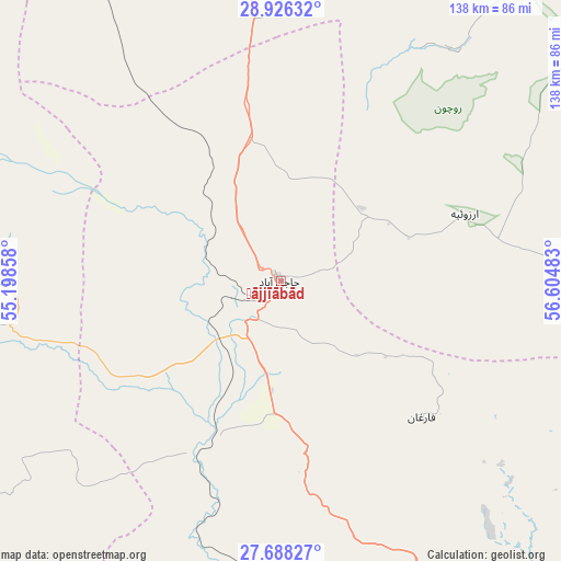
Ḩājjīābād GPS coordinates[2]
28° 18' 32.76" North, 55° 54' 6.12" East
| Map corner | latitude | longitude |
|---|---|---|
| Upper-left | 28.92632°, | 55.19858° |
| Center: | 28.3091°, | 55.9017° |
| Lower-right: | 27.68827°, | 56.60483° |
| Map W x H: | 137.7×137.7 km | = 85.6×85.6mi |
| max Lat: | 39.6482° ⇑91.8% North |
| Ḩājjīābād: | 28.3091° |
| min Lat: | ⇓8.2% South 25.2919° |
| min Long | Ḩājjīābād | max Long |
| 44.38416° | 55.9017° | 61.9965° |
| W 79.6%⇐ | ⇒20.4% E |
Elevation
Elevation of Ḩājjīābād is 926 m = 3038 ft, and this is 123 m = 404 ft below average elevation for this country.
| Max E: |
2564 m = 8412 ft | 62.4% |
| Avg. | 1049 m = 3442 ft | |
| Ḩājjīābād | 926 m = 3038 ft | |
Min E: |
-24 m = -79 ft | 37.6% |
See also: Iran elevation on elevation.city.
Geographical zone
Ḩājjīābād is located in North temperate zone (between Tropic of Cancer and the Arctic Circle). Distance of this Northern Tropic circle is 541.8 km =336.7 mi to South.| Distance of | km | miles | from Ḩājjīābād |
|---|---|---|---|
| North Pole | 6859.4 | 4262.2 | to North |
| Arctic Circle | 4253.5 | 2643 | to North |
| Tropic Cancer | 541.8 | 336.7 | to South |
| Equator | 3147.7 | 1955.9 | to South |


Nearby cities:
15 places around Ḩājjīābād: (largest is in red/bold)
• Arzū’īyeh
48.4 km =30.1 mi,  72°
72°
• Bandar Abbas
130.3 km =81 mi,  163°
163°
• Bandar-e Khamīr
154.1 km =95.8 mi,  191°
191°
• Bāft
123.4 km =76.7 mi,  33°
33°
• Dārāb
141.4 km =87.9 mi,  290°
290°
• Fāryāb
132.4 km =82.3 mi,  100°
100°
• Kahnūj
180.7 km =112.3 mi, 102°
• Kūh Sefīd
138.7 km =86.2 mi,  39°
39°
• Mīnāb
175.4 km =109 mi,  138°
138°
• Qeshm
155.5 km =96.6 mi,  166°
166°
• Rābor
147.1 km =91.4 mi, 42°
• Rūdān
159.3 km =99 mi,  127°
127°
• Shahr-e Qadīm-e Lār
168.2 km =104.5 mi,  245°
245°
• Sirjan
128.8 km =80 mi,  350°
350°
• Ḩājjīābād
144.8 km =90 mi,  272°
272°
Sources, notices
• [Note1] Compared only with cities in Iran existing in our database
• [Src1] Map data: © OpenStreetMap contributors (CC-BY-SA)
• [Src2] Other city data from geonames.org with taken over terms of usage.
• [Src3] Geographical zone / Annual Mean Temperature by Robert A. Rohde @ Wikipedia
