Arzū’īyeh geodata
Arzū’īyeh (Kerman) is a seat of a second-order administrative division; located in Iran in Asia/Tehran (GMT+3.5) time zone. In our database, there are 232 cities with bigger population. Compared to other cities in Iran, 91.4% of cities are located further ↑North; 81.4% of cities are located further ←West and 56.2% of cities have higher elevation than Arzū’īyeh. Note1


Arzū’īyeh GPS coordinates[2]
28° 26' 29.04" North, 56° 22' 22.08" East
| Map corner | latitude | longitude |
|---|---|---|
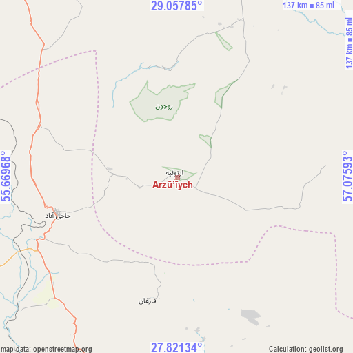
| Upper-left | 29.05785°, | 55.66968° |
| Center: | 28.4414°, | 56.3728° |
| Lower-right: | 27.82134°, | 57.07593° |
| Map W x H: | 137.5×137.5 km | = 85.4×85.4mi |
| max Lat: | 39.6482° ⇑91.4% North |
| Arzū’īyeh: | 28.4414° |
| min Lat: | ⇓8.6% South 25.2919° |
| min Long | Arzū’īyeh | max Long |
| 44.38416° | 56.3728° | 61.9965° |
| W 81.4%⇐ | ⇒18.6% E |
Elevation
Elevation of Arzū’īyeh is 1044 m = 3425 ft, and this is 5 m = 16 ft below average elevation for this country.
| Max E: |
2564 m = 8412 ft | 56.2% |
| Avg. | 1049 m = 3442 ft | |
| Arzū’īyeh | 1044 m = 3425 ft | |
Min E: |
-24 m = -79 ft | 43.8% |
See also: Iran elevation on elevation.city.
Geographical zone
Arzū’īyeh is located in North temperate zone (between Tropic of Cancer and the Arctic Circle). Distance of this Northern Tropic circle is 556.5 km =345.8 mi to South.| Distance of | km | miles | from Arzū’īyeh |
|---|---|---|---|
| North Pole | 6844.7 | 4253.1 | to North |
| Arctic Circle | 4238.8 | 2633.9 | to North |
| Tropic Cancer | 556.5 | 345.8 | to South |
| Equator | 3162.4 | 1965 | to South |


Nearby cities:
15 places around Arzū’īyeh: (largest is in red/bold)
• Bandar Abbas
139.8 km =86.9 mi,  183°
183°
• Bardsīr
165.9 km =103.1 mi,  6°
6°
• Bāft
90.8 km =56.4 mi, 14°
• Eslāmābād
166 km =103.1 mi,  106°
106°
• Fāryāb
92.3 km =57.4 mi, 114°
• Jīroft
136.1 km =84.6 mi,  78°
78°
• Kahnūj
141 km =87.6 mi, 112°
• Kūh Sefīd
101.8 km =63.3 mi,  24°
24°
• Manūjān
159.7 km =99.2 mi,  136°
136°
• Mīnāb
161.8 km =100.5 mi,  154°
154°
• Rābor
108.1 km =67.2 mi,  29°
29°
• Rūdān
137.2 km =85.3 mi, 144°
• Sirjan
130.9 km =81.3 mi,  329°
329°
• Ḩājjīābād
48.4 km =30.1 mi,  252°
252°
• ‘Anbarābād
144.3 km =89.7 mi,  88°
88°
Sources, notices
• [Note1] Compared only with cities in Iran existing in our database
• [Src1] Map data: © OpenStreetMap contributors (CC-BY-SA)
• [Src2] Other city data from geonames.org with taken over terms of usage.
• [Src3] Geographical zone / Annual Mean Temperature by Robert A. Rohde @ Wikipedia
