Rūdān geodata
Rūdān (Hormozgan) is a seat of a second-order administrative division; located in Iran in Asia/Tehran (GMT+3.5) time zone. In our database, there are 232 cities with bigger population. Compared to other cities in Iran, 95.2% of cities are located further ↑North; 84.6% of cities are located further ←West and 79.4% of cities have higher elevation than Rūdān. Note1


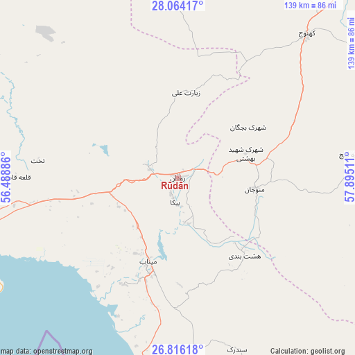
Rūdān GPS coordinates[2]
27° 26' 30.984" North, 57° 11' 31.128" East
| Map corner | latitude | longitude |
|---|---|---|
| Upper-left | 28.06417°, | 56.48886° |
| Center: | 27.44194°, | 57.19198° |
| Lower-right: | 26.81618°, | 57.89511° |
| Map W x H: | 138.8×138.8 km | = 86.2×86.2mi |
| max Lat: | 39.6482° ⇑95.2% North |
| Rūdān: | 27.44194° |
| min Lat: | ⇓4.8% South 25.2919° |
| min Long | Rūdān | max Long |
| 44.38416° | 57.19198° | 61.9965° |
| W 84.6%⇐ | ⇒15.4% E |
Elevation
Elevation of Rūdān is 193 m = 633 ft, and this is 856 m = 2808 ft below average elevation for this country.
| Max E: |
2564 m = 8412 ft | 79.4% |
| Avg. | 1049 m = 3442 ft | |
| Rūdān | 193 m = 633 ft | |
Min E: |
-24 m = -79 ft | 20.6% |
See also: Iran elevation on elevation.city.
Geographical zone
Rūdān is located in North temperate zone (between Tropic of Cancer and the Arctic Circle). Distance of this Northern Tropic circle is 445.3 km =276.7 mi to South.| Distance of | km | miles | from Rūdān |
|---|---|---|---|
| North Pole | 6955.8 | 4322.1 | to North |
| Arctic Circle | 4349.9 | 2702.9 | to North |
| Tropic Cancer | 445.3 | 276.7 | to South |
| Equator | 3051.3 | 1896 | to South |


Nearby cities:
15 places around Rūdān: (largest is in red/bold)
• Arzū’īyeh
137.2 km =85.3 mi,  324°
324°
• Bandar Abbas
94.4 km =58.7 mi,  252°
252°
• Bandar-e Khamīr
168 km =104.4 mi, 251°
• Bāft
207.4 km =128.9 mi,  343°
343°
• Eslāmābād
102.7 km =63.8 mi,  50°
50°
• Fāryāb
73.1 km =45.4 mi,  3°
3°
• Jīroft
147.6 km =91.7 mi,  21°
21°
• Kahnūj
75.6 km =47 mi,  41°
41°
• Manūjān
30.8 km =19.1 mi,  97°
97°
• Mīnāb
36.1 km =22.4 mi,  196°
196°
• Qal‘eh Ganj
68.6 km =42.6 mi,  82°
82°
• Qeshm
106.5 km =66.2 mi,  239°
239°
• Sardasht
130.3 km =81 mi,  147°
147°
• Ḩājjīābād
159.3 km =99 mi,  307°
307°
• ‘Anbarābād
131.8 km =81.9 mi,  29°
29°
Sources, notices
• [Note1] Compared only with cities in Iran existing in our database
• [Src1] Map data: © OpenStreetMap contributors (CC-BY-SA)
• [Src2] Other city data from geonames.org with taken over terms of usage.
• [Src3] Geographical zone / Annual Mean Temperature by Robert A. Rohde @ Wikipedia
