Khondāb geodata
Khondāb (Markazi) is a seat of a second-order administrative division; located in Iran in Asia/Tehran (GMT+3.5) time zone. In our database, there are 232 cities with bigger population. Compared to other cities in Iran, 50.3% of cities are located further ↓South; 69.8% of cities are located further →East and 81.9% of cities have lower elevation than Khondāb. Note1


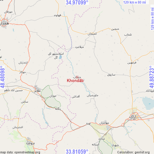
Khondāb GPS coordinates[2]
34° 23' 34.08" North, 49° 11' 2.76" East
| Map corner | latitude | longitude |
|---|---|---|
| Upper-left | 34.97099°, | 48.48098° |
| Center: | 34.3928°, | 49.1841° |
| Lower-right: | 33.81059°, | 49.88723° |
| Map W x H: | 129×129 km | = 80.2×80.2mi |
| max Lat: | 39.6482° ⇑49.7% North |
| Khondāb: | 34.3928° |
| min Lat: | ⇓50.3% South 25.2919° |
| min Long | Khondāb | max Long |
| 44.38416° | 49.1841° | 61.9965° |
| W 30.2%⇐ | ⇒69.8% E |
Elevation
Elevation of Khondāb is 1695 m = 5561 ft, and this is 646 m = 2119 ft above average elevation for this country.
| Max E: |
2564 m = 8412 ft | 18.1% |
| Khondāb | 1695 m 5561 ft | |
| Avg. | 1049 m = 3442 ft | |
Min E: |
-24 m = -79 ft | 81.9% |
See also: Iran elevation on elevation.city.
Geographical zone
Khondāb is located in North temperate zone (between Tropic of Cancer and the Arctic Circle). Distance of this Northern Tropic circle is 1218.2 km =757 mi to South.| Distance of | km | miles | from Khondāb |
|---|---|---|---|
| North Pole | 6182.9 | 3841.9 | to North |
| Arctic Circle | 3577.1 | 2222.7 | to North |
| Tropic Cancer | 1218.2 | 757 | to South |
| Equator | 3824.1 | 2376.2 | to South |


Nearby cities:
15 places around Khondāb: (largest is in red/bold)
• Anūch
64.4 km =40 mi,  240°
240°
• Arāk
57.7 km =35.9 mi,  125°
125°
• Borūjerd
68 km =42.3 mi,  215°
215°
• Famast
77.1 km =47.9 mi, 239°
• Farmahīn
47.5 km =29.5 mi,  74°
74°
• Hamadān
76.1 km =47.3 mi,  306°
306°
• Komījān
38.8 km =24.1 mi,  19°
19°
• Malāyer
34.8 km =21.6 mi,  253°
253°
• Nahāvand
77.7 km =48.3 mi, 253°
• Pasragad Branch
78 km =48.5 mi,  303°
303°
• Shāzand
55.2 km =34.3 mi,  158°
158°
• Tūyserkān
70.1 km =43.6 mi,  284°
284°
• pamas
77.2 km =48 mi, 239°
• Āshtīān
76.7 km =47.7 mi,  79°
79°
• Āzādshahr
71.5 km =44.4 mi, 308°
Sources, notices
• [Note1] Compared only with cities in Iran existing in our database
• [Src1] Map data: © OpenStreetMap contributors (CC-BY-SA)
• [Src2] Other city data from geonames.org with taken over terms of usage.
• [Src3] Geographical zone / Annual Mean Temperature by Robert A. Rohde @ Wikipedia
