Bahār geodata
Bahār (Hamadān) is a seat of a second-order administrative division; located in Iran in Asia/Tehran (GMT+3.5) time zone. With population of 28,645 people, there are 178 cities with bigger population in this country. Compared to other cities in Iran, 55.8% of cities are located further ↓South; 77.6% of cities are located further →East and 82.5% of cities have lower elevation than Bahār. Note1


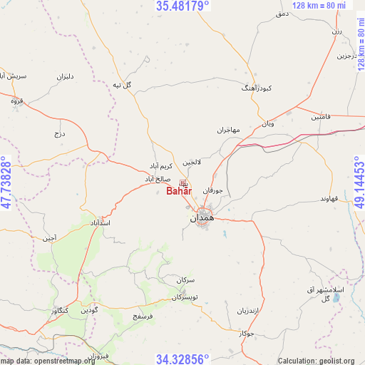
Bahār GPS coordinates[2]
34° 54' 25.92" North, 48° 26' 29.04" East
| Map corner | latitude | longitude |
|---|---|---|
| Upper-left | 35.48179°, | 47.73828° |
| Center: | 34.9072°, | 48.4414° |
| Lower-right: | 34.32856°, | 49.14453° |
| Map W x H: | 128.2×128.2 km | = 79.7×79.7mi |
| max Lat: | 39.6482° ⇑44.2% North |
| Bahār: | 34.9072° |
| min Lat: | ⇓55.8% South 25.2919° |
| min Long | Bahār | max Long |
| 44.38416° | 48.4414° | 61.9965° |
| W 22.4%⇐ | ⇒77.6% E |
Elevation
Elevation of Bahār is 1722 m = 5650 ft, and this is 673 m = 2208 ft above average elevation for this country.
| Max E: |
2564 m = 8412 ft | 17.5% |
| Bahār | 1722 m 5650 ft | |
| Avg. | 1049 m = 3442 ft | |
Min E: |
-24 m = -79 ft | 82.5% |
See also: Iran elevation on elevation.city.
Geographical zone
Bahār is located in North temperate zone (between Tropic of Cancer and the Arctic Circle). Distance of this Northern Tropic circle is 1275.4 km =792.5 mi to South.| Distance of | km | miles | from Bahār |
|---|---|---|---|
| North Pole | 6125.7 | 3806.3 | to North |
| Arctic Circle | 3519.9 | 2187.2 | to North |
| Tropic Cancer | 1275.4 | 792.5 | to South |
| Equator | 3881.3 | 2411.7 | to South |


Nearby cities:
15 places around Bahār: (largest is in red/bold)
• Asadābād
32.4 km =20.1 mi,  244°
244°
• Fāmenīn
53.7 km =33.4 mi,  64°
64°
• Hamadān
13.7 km =8.5 mi,  150°
150°
• Kabūdarāhang
42.3 km =26.3 mi,  37°
37°
• Kangāvar
62.5 km =38.8 mi,  224°
224°
• Komījān
83.4 km =51.8 mi,  104°
104°
• Malāyer
75.8 km =47.1 mi, 152°
• Nahāvand
79.9 km =49.6 mi,  184°
184°
• Pasragad Branch
14.7 km =9.1 mi,  169°
169°
• Qohūrd-e ‘Olyā
68 km =42.3 mi,  330°
330°
• Qorveh
64.7 km =40.2 mi,  296°
296°
• Razan
75.7 km =47 mi,  45°
45°
• Sonqor
78.1 km =48.5 mi,  259°
259°
• Tūyserkān
39.6 km =24.6 mi, 179°
• Āzādshahr
17.5 km =10.9 mi,  137°
137°
Sources, notices
• [Note1] Compared only with cities in Iran existing in our database
• [Src1] Map data: © OpenStreetMap contributors (CC-BY-SA)
• [Src2] Other city data from geonames.org with taken over terms of usage.
• [Src3] Geographical zone / Annual Mean Temperature by Robert A. Rohde @ Wikipedia
