Kūh Sefīd geodata
Kūh Sefīd (Kerman) is a populated place; located in Iran in Asia/Tehran (GMT+3.5) time zone. With population of 2,850 people, there are 217 cities with bigger population in this country. Compared to other cities in Iran, 85.9% of cities are located further ↑North; 82.8% of cities are located further ←West and 100% of cities have lower elevation than Kūh Sefīd. Note1


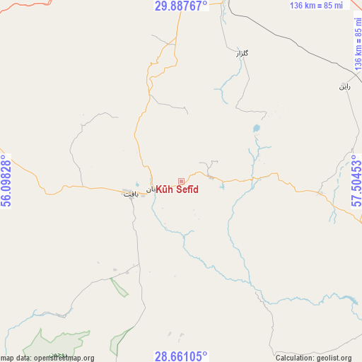
Kūh Sefīd GPS coordinates[2]
29° 16' 34.32" North, 56° 48' 5.04" East
| Map corner | latitude | longitude |
|---|---|---|
| Upper-left | 29.88767°, | 56.09828° |
| Center: | 29.2762°, | 56.8014° |
| Lower-right: | 28.66105°, | 57.50453° |
| Map W x H: | 136.4×136.4 km | = 84.8×84.8mi |
| max Lat: | 39.6482° ⇑85.9% North |
| Kūh Sefīd: | 29.2762° |
| min Lat: | ⇓14.1% South 25.2919° |
| min Long | Kūh Sefīd | max Long |
| 44.38416° | 56.8014° | 61.9965° |
| W 82.8%⇐ | ⇒17.2% E |
Elevation
Elevation of Kūh Sefīd is 2564 m = 8412 ft, and this is 1515 m = 4970 ft above average elevation for this country.
| Max E: |
2564 m = 8412 ft | 0% |
| Kūh Sefīd | 2564 m 8412 ft | |
| Avg. | 1049 m = 3442 ft | |
Min E: |
-24 m = -79 ft | 100% |
See also: Iran elevation on elevation.city.
Geographical zone
Kūh Sefīd is located in North temperate zone (between Tropic of Cancer and the Arctic Circle). Distance of this Northern Tropic circle is 649.3 km =403.5 mi to South.| Distance of | km | miles | from Kūh Sefīd |
|---|---|---|---|
| North Pole | 6751.9 | 4195.4 | to North |
| Arctic Circle | 4146 | 2576.2 | to North |
| Tropic Cancer | 649.3 | 403.5 | to South |
| Equator | 3255.2 | 2022.7 | to South |


Nearby cities:
15 places around Kūh Sefīd: (largest is in red/bold)
• Arzū’īyeh
101.8 km =63.3 mi,  204°
204°
• Bam
152.2 km =94.6 mi,  97°
97°
• Bardsīr
75.2 km =46.7 mi,  343°
343°
• Bāft
19.9 km =12.4 mi,  256°
256°
• Eslāmābād
181.7 km =112.9 mi,  139°
139°
• Fāryāb
137.5 km =85.4 mi,  162°
162°
• Jīroft
113 km =70.2 mi,  126°
126°
• Kahnūj
171.4 km =106.5 mi,  149°
149°
• Kerman
115.1 km =71.5 mi,  13°
13°
• Rafsanjān
147.9 km =91.9 mi,  328°
328°
• Rābor
11 km =6.8 mi,  81°
81°
• Sirjan
110.3 km =68.5 mi,  280°
280°
• Zarand
172.4 km =107.1 mi,  352°
352°
• Ḩājjīābād
138.7 km =86.2 mi,  219°
219°
• ‘Anbarābād
135.3 km =84.1 mi, 131°
Sources, notices
• [Note1] Compared only with cities in Iran existing in our database
• [Src1] Map data: © OpenStreetMap contributors (CC-BY-SA)
• [Src2] Other city data from geonames.org with taken over terms of usage.
• [Src3] Geographical zone / Annual Mean Temperature by Robert A. Rohde @ Wikipedia
