Nehbandān geodata
Nehbandān (Khorāsān-e Jonūbī) is a seat of a second-order administrative division; located in Iran in Asia/Tehran (GMT+3.5) time zone. In our database, there are 232 cities with bigger population. Compared to other cities in Iran, 72.3% of cities are located further ↑North; 95.9% of cities are located further ←West and 52.2% of cities have lower elevation than Nehbandān. Note1


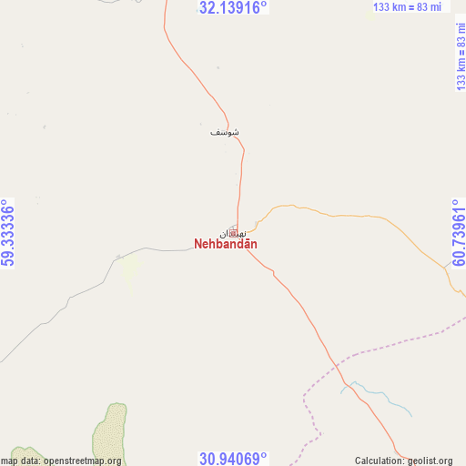
Nehbandān GPS coordinates[2]
31° 32' 30.66" North, 60° 2' 11.328" East
| Map corner | latitude | longitude |
|---|---|---|
| Upper-left | 32.13916°, | 59.33336° |
| Center: | 31.54185°, | 60.03648° |
| Lower-right: | 30.94069°, | 60.73961° |
| Map W x H: | 133.3×133.3 km | = 82.8×82.8mi |
| max Lat: | 39.6482° ⇑72.3% North |
| Nehbandān: | 31.54185° |
| min Lat: | ⇓27.7% South 25.2919° |
| min Long | Nehbandān | max Long |
| 44.38416° | 60.03648° | 61.9965° |
| W 95.9%⇐ | ⇒4.1% E |
Elevation
Elevation of Nehbandān is 1187 m = 3894 ft, and this is 138 m = 453 ft above average elevation for this country.
| Max E: |
2564 m = 8412 ft | 47.8% |
| Nehbandān | 1187 m 3894 ft | |
| Avg. | 1049 m = 3442 ft | |
Min E: |
-24 m = -79 ft | 52.2% |
See also: Iran elevation on elevation.city.
Geographical zone
Nehbandān is located in North temperate zone (between Tropic of Cancer and the Arctic Circle). Distance of this Northern Tropic circle is 901.2 km =560 mi to South.| Distance of | km | miles | from Nehbandān |
|---|---|---|---|
| North Pole | 6499.9 | 4038.8 | to North |
| Arctic Circle | 3894 | 2419.6 | to North |
| Tropic Cancer | 901.2 | 560 | to South |
| Equator | 3507.1 | 2179.2 | to South |


Nearby cities:
15 places around Nehbandān: (largest is in red/bold)
• Asadīyeh
158.6 km =98.5 mi,  349°
349°
• Bam
315.2 km =195.9 mi,  210°
210°
• Bīrjand
166 km =103.1 mi,  332°
332°
• Dūst Moḩammad Khān
172.5 km =107.2 mi,  104°
104°
• Fahraj
308.7 km =191.8 mi,  200°
200°
• Kerman
314.9 km =195.7 mi,  243°
243°
• Noşratābād
182.6 km =113.5 mi,  181°
181°
• Qā’en
255.7 km =158.9 mi,  341°
341°
• Rāvar
308.2 km =191.5 mi,  264°
264°
• Sarbīsheh
117.1 km =72.8 mi, 348°
• Sarāyān
294.2 km =182.8 mi, 331°
• Zahedan
240.8 km =149.6 mi,  160°
160°
• Zehak
172.1 km =106.9 mi,  114°
114°
• Zābol
149.8 km =93.1 mi, 112°
• Ḩājjīābād
229.4 km =142.5 mi,  358°
358°
Sources, notices
• [Note1] Compared only with cities in Iran existing in our database
• [Src1] Map data: © OpenStreetMap contributors (CC-BY-SA)
• [Src2] Other city data from geonames.org with taken over terms of usage.
• [Src3] Geographical zone / Annual Mean Temperature by Robert A. Rohde @ Wikipedia
