Zarand geodata
Zarand (Kerman) is a seat of a second-order administrative division; located in Iran in Asia/Tehran (GMT+3.5) time zone. With population of 58,983 people, there are 108 cities with bigger population in this country. Compared to other cities in Iran, 77.6% of cities are located further ↑North; 82.1% of cities are located further ←West and 80.3% of cities have lower elevation than Zarand. Note1


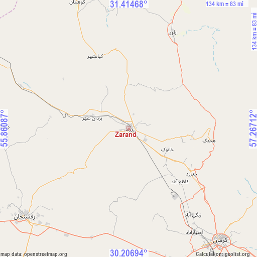
Zarand GPS coordinates[2]
30° 48' 45.756" North, 56° 33' 50.364" East
| Map corner | latitude | longitude |
|---|---|---|
| Upper-left | 31.41468°, | 55.86087° |
| Center: | 30.81271°, | 56.56399° |
| Lower-right: | 30.20694°, | 57.26712° |
| Map W x H: | 134.3×134.3 km | = 83.5×83.5mi |
| max Lat: | 39.6482° ⇑77.6% North |
| Zarand: | 30.81271° |
| min Lat: | ⇓22.4% South 25.2919° |
| min Long | Zarand | max Long |
| 44.38416° | 56.56399° | 61.9965° |
| W 82.1%⇐ | ⇒17.9% E |
Elevation
Elevation of Zarand is 1656 m = 5433 ft, and this is 607 m = 1991 ft above average elevation for this country.
| Max E: |
2564 m = 8412 ft | 19.7% |
| Zarand | 1656 m 5433 ft | |
| Avg. | 1049 m = 3442 ft | |
Min E: |
-24 m = -79 ft | 80.3% |
See also: Zarand elevation on elevation.city.
Geographical zone
Zarand is located in North temperate zone (between Tropic of Cancer and the Arctic Circle). Distance of this Northern Tropic circle is 820.1 km =509.6 mi to South.| Distance of | km | miles | from Zarand |
|---|---|---|---|
| North Pole | 6581 | 4089.2 | to North |
| Arctic Circle | 3975.1 | 2470 | to North |
| Tropic Cancer | 820.1 | 509.6 | to South |
| Equator | 3426.1 | 2128.9 | to South |


Nearby cities:
15 places around Zarand: (largest is in red/bold)
• Anār
123.7 km =76.9 mi,  272°
272°
• Bahābād
128.3 km =79.7 mi,  336°
336°
• Bardsīr
99 km =61.5 mi,  179°
179°
• Bāfq
141.2 km =87.7 mi,  308°
308°
• Bāft
175.7 km =109.2 mi, 178°
• Kerman
76.8 km =47.7 mi,  140°
140°
• Kūh Sefīd
172.4 km =107.1 mi,  172°
172°
• Kūhbanān
71.6 km =44.5 mi, 338°
• Mahrīz
219.2 km =136.2 mi,  293°
293°
• Rafsanjān
70.8 km =44 mi,  230°
230°
• Rābor
172.5 km =107.2 mi, 168°
• Rāvar
55.4 km =34.4 mi,  24°
24°
• Shahr-e Bābak
158.7 km =98.6 mi,  240°
240°
• Shahrak-e Pābedānā
39.1 km =24.3 mi, 336°
• Sirjan
173.6 km =107.9 mi,  209°
209°
Sources, notices
• [Note1] Compared only with cities in Iran existing in our database
• [Src1] Map data: © OpenStreetMap contributors (CC-BY-SA)
• [Src2] Other city data from geonames.org with taken over terms of usage.
• [Src3] Geographical zone / Annual Mean Temperature by Robert A. Rohde @ Wikipedia
