Shahrak-e Pābedānā geodata
Shahrak-e Pābedānā (Kerman) is a populated place; located in Iran in Asia/Tehran (GMT+3.5) time zone. With population of 6,503 people, there are 209 cities with bigger population in this country. Compared to other cities in Iran, 75.5% of cities are located further ↑North; 81.9% of cities are located further ←West and 96.4% of cities have lower elevation than Shahrak-e Pābedānā. Note1


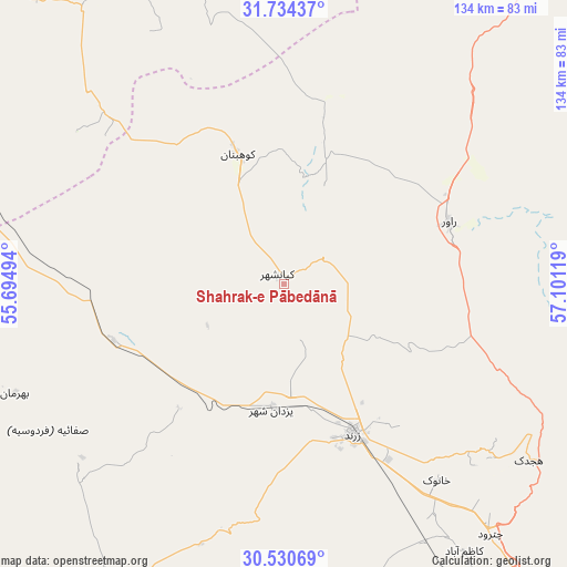
Shahrak-e Pābedānā GPS coordinates[2]
31° 8' 3.984" North, 56° 23' 53.016" East
| Map corner | latitude | longitude |
|---|---|---|
| Upper-left | 31.73437°, | 55.69494° |
| Center: | 31.13444°, | 56.39806° |
| Lower-right: | 30.53069°, | 57.10119° |
| Map W x H: | 133.8×133.8 km | = 83.1×83.1mi |
| max Lat: | 39.6482° ⇑75.5% North |
| Shahrak-e Pābedānā: | 31.13444° |
| min Lat: | ⇓24.5% South 25.2919° |
| min Long | Shahrak-e Pābe | max Long |
| 44.38416° | 56.39806° | 61.9965° |
| W 81.9%⇐ | ⇒18.1% E |
Elevation
Elevation of Shahrak-e Pābedānā is 2117 m = 6946 ft, and this is 1068 m = 3504 ft above average elevation for this country.
| Max E: |
2564 m = 8412 ft | 3.6% |
| Shahrak-e Pābedānā | 2117 m 6946 ft | |
| Avg. | 1049 m = 3442 ft | |
Min E: |
-24 m = -79 ft | 96.4% |
See also: Iran elevation on elevation.city.
Geographical zone
Shahrak-e Pābedānā is located in North temperate zone (between Tropic of Cancer and the Arctic Circle). Distance of this Northern Tropic circle is 855.9 km =531.8 mi to South.| Distance of | km | miles | from Shahrak-e Pābedānā |
|---|---|---|---|
| North Pole | 6545.2 | 4067 | to North |
| Arctic Circle | 3939.3 | 2447.8 | to North |
| Tropic Cancer | 855.9 | 531.8 | to South |
| Equator | 3461.8 | 2151.1 | to South |


Nearby cities:
15 places around Shahrak-e Pābedānā: (largest is in red/bold)
• Anār
111.4 km =69.2 mi,  254°
254°
• Bahābād
89.2 km =55.4 mi,  336°
336°
• Bardsīr
135.8 km =84.4 mi,  172°
172°
• Bāfq
108 km =67.1 mi,  298°
298°
• Kerman
114.9 km =71.4 mi,  145°
145°
• Kūh Sefīd
210.2 km =130.6 mi, 169°
• Kūhbanān
32.6 km =20.3 mi, 340°
• Mahrīz
192.3 km =119.5 mi,  285°
285°
• Rafsanjān
89.7 km =55.7 mi,  205°
205°
• Rābor
210.8 km =131 mi, 166°
• Rāvar
41.4 km =25.7 mi,  69°
69°
• Shahr-e Bābak
166.7 km =103.6 mi,  227°
227°
• Sirjan
199.4 km =123.9 mi,  200°
200°
• Yazd
210.3 km =130.7 mi, 293°
• Zarand
39.1 km =24.3 mi,  156°
156°
Sources, notices
• [Note1] Compared only with cities in Iran existing in our database
• [Src1] Map data: © OpenStreetMap contributors (CC-BY-SA)
• [Src2] Other city data from geonames.org with taken over terms of usage.
• [Src3] Geographical zone / Annual Mean Temperature by Robert A. Rohde @ Wikipedia
