Chingirlau geodata
Chingirlau (Batys Qazaqstan) is a populated place; located in Kazakhstan in Asia/Oral (GMT+5) time zone. With population of 6,218 people, there are 166 cities with bigger population in this country. Compared to other cities in Kazakhstan, 74.8% of cities are located further ↓South; 85.9% of cities are located further →East and 81.9% of cities have higher elevation than Chingirlau. Note1


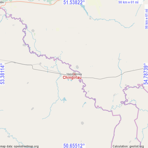
Chingirlau GPS coordinates[2]
51° 5' 55.608" North, 54° 5' 3.336" East
| Map corner | latitude | longitude |
|---|---|---|
| Upper-left | 51.53822°, | 53.38114° |
| Center: | 51.09878°, | 54.08426° |
| Lower-right: | 50.65512°, | 54.78739° |
| Map W x H: | 98.2×98.2 km | = 61×61mi |
| max Lat: | 54.90596° ⇑25.2% North |
| Chingirlau: | 51.09878° |
| min Lat: | ⇓74.8% South 40.66338° |
| min Long | Chingirlau | max Long |
| 46.83361° | 54.08426° | 84.87144° |
| W 14.1%⇐ | ⇒85.9% E |
Elevation
Elevation of Chingirlau is 109 m = 358 ft, and this is 247.5 m = 812 ft below average elevation for this country.
| Max E: |
1847 m = 6060 ft | 81.9% |
| Avg. | 356.5 m = 1170 ft | |
| Chingirlau | 109 m = 358 ft | |
Min E: |
-26 m = -85 ft | 18.1% |
See also: Kazakhstan elevation on elevation.city.
Geographical zone
Chingirlau is located in North temperate zone (between Tropic of Cancer and the Arctic Circle). Distance of this North polar circle is 1719.5 km =1068.4 mi to North.| Distance of | km | miles | from Chingirlau |
|---|---|---|---|
| North Pole | 4325.4 | 2687.7 | to North |
| Arctic Circle | 1719.5 | 1068.4 | to North |
| Tropic Cancer | 3075.7 | 1911.2 | to South |
| Equator | 5681.7 | 3530.4 | to South |


Nearby cities:
15 places around Chingirlau: (largest is in red/bold)
• Akkol’
266.6 km =165.7 mi,  193°
193°
• Aktobe
238.1 km =147.9 mi,  112°
112°
• Aqsay
76.2 km =47.3 mi,  275°
275°
• Bayganin
297 km =184.5 mi,  154°
154°
• Burlin
102.1 km =63.4 mi,  290°
290°
• Chapaev
228.7 km =142.1 mi,  244°
244°
• Dzhambeyty
140.4 km =87.2 mi,  228°
228°
• Fedorovka
148.9 km =92.5 mi, 275°
• Krūgloozernoe
195.2 km =121.3 mi,  269°
269°
• Martuk
174.2 km =108.2 mi,  102°
102°
• Miyaly
247 km =153.5 mi,  184°
184°
• Oral
190.1 km =118.1 mi, 274°
• Peremetnoe
225.5 km =140.1 mi, 272°
• Shubarkuduk
276.5 km =171.8 mi,  141°
141°
• Tasqala
264.6 km =164.4 mi, 270°
Sources, notices
• [Note1] Compared only with cities in Kazakhstan existing in our database
• [Src1] Map data: © OpenStreetMap contributors (CC-BY-SA)
• [Src2] Other city data from geonames.org with taken over terms of usage.
• [Src3] Geographical zone / Annual Mean Temperature by Robert A. Rohde @ Wikipedia
