Embi geodata
Embi (Aqtöbe) is a populated place; located in Kazakhstan in Asia/Aqtobe (GMT+5) time zone. With population of 18,760 people, there are 70 cities with bigger population in this country. Compared to other cities in Kazakhstan, 50.4% of cities are located further ↓South; 82.2% of cities are located further →East and 60.7% of cities have higher elevation than Embi. Note1


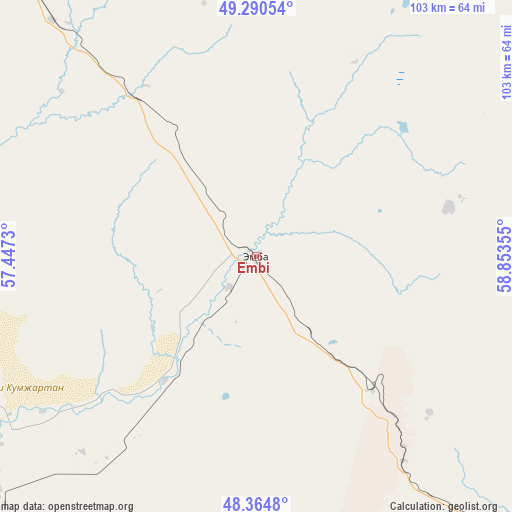
Embi GPS coordinates[2]
48° 49' 47.316" North, 58° 9' 1.512" East
| Map corner | latitude | longitude |
|---|---|---|
| Upper-left | 49.29054°, | 57.4473° |
| Center: | 48.82981°, | 58.15042° |
| Lower-right: | 48.3648°, | 58.85355° |
| Map W x H: | 102.9×102.9 km | = 63.9×63.9mi |
| max Lat: | 54.90596° ⇑49.6% North |
| Embi: | 48.82981° |
| min Lat: | ⇓50.4% South 40.66338° |
| min Long | Embi | max Long |
| 46.83361° | 58.15042° | 84.87144° |
| W 17.8%⇐ | ⇒82.2% E |
Elevation
Elevation of Embi is 233 m = 764 ft, and this is 123.5 m = 405 ft below average elevation for this country.
| Max E: |
1847 m = 6060 ft | 60.7% |
| Avg. | 356.5 m = 1170 ft | |
| Embi | 233 m = 764 ft | |
Min E: |
-26 m = -85 ft | 39.3% |
See also: Kazakhstan elevation on elevation.city.
Geographical zone
Embi is located in North temperate zone (between Tropic of Cancer and the Arctic Circle). Distance of this North polar circle is 1971.8 km =1225.2 mi to North.| Distance of | km | miles | from Embi |
|---|---|---|---|
| North Pole | 4577.7 | 2844.5 | to North |
| Arctic Circle | 1971.8 | 1225.2 | to North |
| Tropic Cancer | 2823.4 | 1754.4 | to South |
| Equator | 5429.4 | 3373.7 | to South |


Nearby cities:
13 places around Embi: (largest is in red/bold)
• Aktobe
175 km =108.7 mi,  337°
337°
• Batamshinskiy
192.6 km =119.7 mi,  2°
2°
• Bayganin
167.5 km =104.1 mi,  264°
264°
• Biikzhal
341.8 km =212.4 mi,  228°
228°
• Kandyagash
88.8 km =55.2 mi,  323°
323°
• Khromtau
159.4 km =99 mi,  7°
7°
• Martuk
243.7 km =151.4 mi,  331°
331°
• Sekseūil
295.5 km =183.6 mi,  130°
130°
• Shalqar
154.1 km =95.8 mi,  135°
135°
• Shubarkuduk
126.6 km =78.7 mi,  286°
286°
• Shubarshi
76.2 km =47.3 mi,  248°
248°
• Temir
82.2 km =51.1 mi, 294°
• Yrghyz
229.8 km =142.8 mi,  95°
95°
Sources, notices
• [Note1] Compared only with cities in Kazakhstan existing in our database
• [Src1] Map data: © OpenStreetMap contributors (CC-BY-SA)
• [Src2] Other city data from geonames.org with taken over terms of usage.
• [Src3] Geographical zone / Annual Mean Temperature by Robert A. Rohde @ Wikipedia
