Batamshinskiy geodata
Batamshinskiy (Aqtöbe) is a populated place; located in Kazakhstan in Asia/Aqtobe (GMT+5) time zone. With population of 5,668 people, there are 178 cities with bigger population in this country. Compared to other cities in Kazakhstan, 71.1% of cities are located further ↓South; 81.9% of cities are located further →East and 64.8% of cities have lower elevation than Batamshinskiy. Note1


Batamshinskiy GPS coordinates[2]
50° 33' 36.792" North, 58° 16' 37.74" East
| Map corner | latitude | longitude |
|---|---|---|
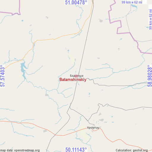
| Upper-left | 51.00478°, | 57.57403° |
| Center: | 50.56022°, | 58.27715° |
| Lower-right: | 50.11143°, | 58.98028° |
| Map W x H: | 99.3×99.3 km | = 61.7×61.7mi |
| max Lat: | 54.90596° ⇑28.9% North |
| Batamshinskiy: | 50.56022° |
| min Lat: | ⇓71.1% South 40.66338° |
| min Long | Batamshinskiy | max Long |
| 46.83361° | 58.27715° | 84.87144° |
| W 18.1%⇐ | ⇒81.9% E |
Elevation
Elevation of Batamshinskiy is 426 m = 1398 ft, and this is 69.5 m = 228 ft above average elevation for this country.
| Max E: |
1847 m = 6060 ft | 35.2% |
| Batamshinskiy | 426 m 1398 ft | |
| Avg. | 356.5 m = 1170 ft | |
Min E: |
-26 m = -85 ft | 64.8% |
See also: Kazakhstan elevation on elevation.city.
Geographical zone
Batamshinskiy is located in North temperate zone (between Tropic of Cancer and the Arctic Circle). Distance of this North polar circle is 1779.4 km =1105.7 mi to North.| Distance of | km | miles | from Batamshinskiy |
|---|---|---|---|
| North Pole | 4385.3 | 2724.9 | to North |
| Arctic Circle | 1779.4 | 1105.7 | to North |
| Tropic Cancer | 3015.9 | 1874 | to South |
| Equator | 5621.8 | 3493.2 | to South |


Nearby cities:
13 places around Batamshinskiy: (largest is in red/bold)
• Aktobe
82 km =51 mi,  247°
247°
• Bayganin
270.5 km =168.1 mi,  219°
219°
• Dzhetygara
271.9 km =169 mi,  48°
48°
• Embi
192.6 km =119.7 mi,  182°
182°
• Kandyagash
135.9 km =84.4 mi,  206°
206°
• Khromtau
36.2 km =22.5 mi,  161°
161°
• Martuk
126.6 km =78.7 mi,  279°
279°
• Ordzhonikidze
319 km =198.2 mi, 48°
• Shalqar
318.1 km =197.7 mi, 162°
• Shubarkuduk
203.4 km =126.4 mi, 219°
• Shubarshi
233.9 km =145.3 mi,  199°
199°
• Temir
178 km =110.6 mi, 207°
• Yrghyz
305.1 km =189.6 mi,  135°
135°
Sources, notices
• [Note1] Compared only with cities in Kazakhstan existing in our database
• [Src1] Map data: © OpenStreetMap contributors (CC-BY-SA)
• [Src2] Other city data from geonames.org with taken over terms of usage.
• [Src3] Geographical zone / Annual Mean Temperature by Robert A. Rohde @ Wikipedia
