Kandyagash geodata
Kandyagash (Aqtöbe) is a populated place; located in Kazakhstan in Asia/Aqtobe (GMT+5) time zone. With population of 28,196 people, there are 53 cities with bigger population in this country. Compared to other cities in Kazakhstan, 55.9% of cities are located further ↓South; 82.6% of cities are located further →East and 53% of cities have higher elevation than Kandyagash. Note1


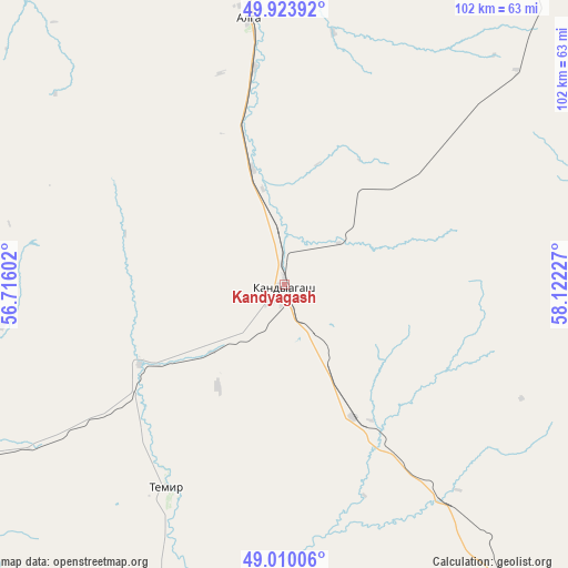
Kandyagash GPS coordinates[2]
49° 28' 8.832" North, 57° 25' 8.904" East
| Map corner | latitude | longitude |
|---|---|---|
| Upper-left | 49.92392°, | 56.71602° |
| Center: | 49.46912°, | 57.41914° |
| Lower-right: | 49.01006°, | 58.12227° |
| Map W x H: | 101.6×101.6 km | = 63.1×63.1mi |
| max Lat: | 54.90596° ⇑44.1% North |
| Kandyagash: | 49.46912° |
| min Lat: | ⇓55.9% South 40.66338° |
| min Long | Kandyagash | max Long |
| 46.83361° | 57.41914° | 84.87144° |
| W 17.4%⇐ | ⇒82.6% E |
Elevation
Elevation of Kandyagash is 294 m = 965 ft, and this is 62.5 m = 205 ft below average elevation for this country.
| Max E: |
1847 m = 6060 ft | 53% |
| Avg. | 356.5 m = 1170 ft | |
| Kandyagash | 294 m = 965 ft | |
Min E: |
-26 m = -85 ft | 47% |
See also: Kazakhstan elevation on elevation.city.
Geographical zone
Kandyagash is located in North temperate zone (between Tropic of Cancer and the Arctic Circle). Distance of this North polar circle is 1900.7 km =1181 mi to North.| Distance of | km | miles | from Kandyagash |
|---|---|---|---|
| North Pole | 4506.6 | 2800.3 | to North |
| Arctic Circle | 1900.7 | 1181 | to North |
| Tropic Cancer | 2894.5 | 1798.6 | to South |
| Equator | 5500.5 | 3417.9 | to South |


Nearby cities:
14 places around Kandyagash: (largest is in red/bold)
• Aktobe
91.4 km =56.8 mi,  350°
350°
• Batamshinskiy
135.9 km =84.4 mi,  26°
26°
• Bayganin
142 km =88.2 mi,  232°
232°
• Biikzhal
358.6 km =222.8 mi,  213°
213°
• Chingirlau
298.2 km =185.3 mi,  307°
307°
• Embi
88.8 km =55.2 mi,  143°
143°
• Khromtau
113.6 km =70.6 mi,  40°
40°
• Martuk
156.3 km =97.1 mi,  335°
335°
• Miyaly
271.5 km =168.7 mi,  256°
256°
• Shalqar
242.4 km =150.6 mi, 138°
• Shubarkuduk
77 km =47.8 mi,  241°
241°
• Shubarshi
100.3 km =62.3 mi,  189°
189°
• Temir
42.1 km =26.2 mi, 210°
• Yrghyz
296 km =183.9 mi,  108°
108°
Sources, notices
• [Note1] Compared only with cities in Kazakhstan existing in our database
• [Src1] Map data: © OpenStreetMap contributors (CC-BY-SA)
• [Src2] Other city data from geonames.org with taken over terms of usage.
• [Src3] Geographical zone / Annual Mean Temperature by Robert A. Rohde @ Wikipedia
