Ordzhonikidze geodata
Ordzhonikidze (Qostanay) is a populated place; located in Kazakhstan in Asia/Qostanay (GMT+5) time zone. With population of 4,919 people, there are 196 cities with bigger population in this country. Compared to other cities in Kazakhstan, 85.6% of cities are located further ↓South; 79.3% of cities are located further →East and 61.9% of cities have higher elevation than Ordzhonikidze. Note1


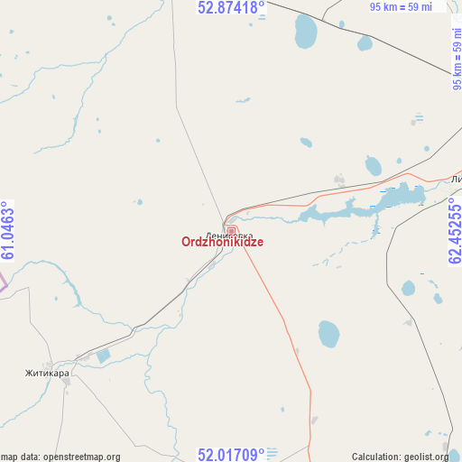
Ordzhonikidze GPS coordinates[2]
52° 26' 51.792" North, 61° 44' 57.912" East
| Map corner | latitude | longitude |
|---|---|---|
| Upper-left | 52.87418°, | 61.0463° |
| Center: | 52.44772°, | 61.74942° |
| Lower-right: | 52.01709°, | 62.45255° |
| Map W x H: | 95.3×95.3 km | = 59.2×59.2mi |
| max Lat: | 54.90596° ⇑14.4% North |
| Ordzhonikidze: | 52.44772° |
| min Lat: | ⇓85.6% South 40.66338° |
| min Long | Ordzhonikidze | max Long |
| 46.83361° | 61.74942° | 84.87144° |
| W 20.7%⇐ | ⇒79.3% E |
Elevation
Elevation of Ordzhonikidze is 228 m = 748 ft, and this is 128.5 m = 422 ft below average elevation for this country.
| Max E: |
1847 m = 6060 ft | 61.9% |
| Avg. | 356.5 m = 1170 ft | |
| Ordzhonikidze | 228 m = 748 ft | |
Min E: |
-26 m = -85 ft | 38.1% |
See also: Kazakhstan elevation on elevation.city.
Geographical zone
Ordzhonikidze is located in North temperate zone (between Tropic of Cancer and the Arctic Circle). Distance of this North polar circle is 1569.5 km =975.2 mi to North.| Distance of | km | miles | from Ordzhonikidze |
|---|---|---|---|
| North Pole | 4175.4 | 2594.5 | to North |
| Arctic Circle | 1569.5 | 975.2 | to North |
| Tropic Cancer | 3225.7 | 2004.4 | to South |
| Equator | 5831.6 | 3623.6 | to South |


Nearby cities:
15 places around Ordzhonikidze: (largest is in red/bold)
• Ayat
67.6 km =42 mi,  50°
50°
• Batamshinskiy
319 km =198.2 mi,  228°
228°
• Borovskoy
220.7 km =137.1 mi, 47°
• Dzhetygara
47.1 km =29.3 mi, 232°
• Fyodorovka
146.7 km =91.2 mi,  25°
25°
• Karasu
253.6 km =157.6 mi,  84°
84°
• Khromtau
335.3 km =208.3 mi,  223°
223°
• Komsomolets
146.3 km =90.9 mi,  8°
8°
• Kostanay
152.1 km =94.5 mi,  55°
55°
• Lisakovsk
52 km =32.3 mi, 77°
• Qashar
126.9 km =78.9 mi,  36°
36°
• Qusmuryn
194.5 km =120.9 mi,  89°
89°
• Rudnyy
109.1 km =67.8 mi, 57°
• Tobol
63.1 km =39.2 mi, 64°
• Torghay
335.9 km =208.7 mi,  158°
158°
Sources, notices
• [Note1] Compared only with cities in Kazakhstan existing in our database
• [Src1] Map data: © OpenStreetMap contributors (CC-BY-SA)
• [Src2] Other city data from geonames.org with taken over terms of usage.
• [Src3] Geographical zone / Annual Mean Temperature by Robert A. Rohde @ Wikipedia
