Zhelezinka geodata
Zhelezinka (Pavlodar Region) is a populated place; located in Kazakhstan in Asia/Almaty (GMT+5) time zone. With population of 5,225 people, there are 188 cities with bigger population in this country. Compared to other cities in Kazakhstan, 94.4% of cities are located further ↓South; 73.7% of cities are located further ←West and 84.4% of cities have higher elevation than Zhelezinka. Note1


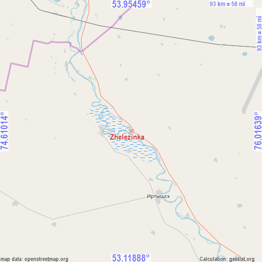
Zhelezinka GPS coordinates[2]
53° 32' 19.68" North, 75° 18' 47.736" East
| Map corner | latitude | longitude |
|---|---|---|
| Upper-left | 53.95459°, | 74.61014° |
| Center: | 53.5388°, | 75.31326° |
| Lower-right: | 53.11888°, | 76.01639° |
| Map W x H: | 92.9×92.9 km | = 57.7×57.7mi |
| max Lat: | 54.90596° ⇑5.6% North |
| Zhelezinka: | 53.5388° |
| min Lat: | ⇓94.4% South 40.66338° |
| min Long | Zhelezinka | max Long |
| 46.83361° | 75.31326° | 84.87144° |
| W 73.7%⇐ | ⇒26.3% E |
Elevation
Elevation of Zhelezinka is 92 m = 302 ft, and this is 264.5 m = 868 ft below average elevation for this country.
| Max E: |
1847 m = 6060 ft | 84.4% |
| Avg. | 356.5 m = 1170 ft | |
| Zhelezinka | 92 m = 302 ft | |
Min E: |
-26 m = -85 ft | 15.6% |
See also: Kazakhstan elevation on elevation.city.
Geographical zone
Zhelezinka is located in North temperate zone (between Tropic of Cancer and the Arctic Circle). Distance of this North polar circle is 1448.2 km =899.9 mi to North.| Distance of | km | miles | from Zhelezinka |
|---|---|---|---|
| North Pole | 4054.1 | 2519.1 | to North |
| Arctic Circle | 1448.2 | 899.9 | to North |
| Tropic Cancer | 3347 | 2079.7 | to South |
| Equator | 5953 | 3699 | to South |


Nearby cities:
15 places around Zhelezinka: (largest is in red/bold)
• Aksu
198.8 km =123.5 mi,  146°
146°
• Aksu
255.4 km =158.7 mi,  241°
241°
• Bestobe
188.1 km =116.9 mi,  232°
232°
• Ekibastuz
201.8 km =125.4 mi,  179°
179°
• Irtyshsk
24.7 km =15.3 mi,  157°
157°
• Kalkaman
182.7 km =113.5 mi, 164°
• Kzyltu
196.5 km =122.1 mi,  273°
273°
• Leninskiy
173.6 km =107.9 mi, 145°
• Mayqayyng
233.5 km =145.1 mi,  171°
171°
• Pavlodar
178.3 km =110.8 mi,  141°
141°
• Qashyr
74.3 km =46.2 mi,  134°
134°
• Stepnogorsk
265.1 km =164.7 mi, 240°
• Talshik
227.2 km =141.2 mi, 272°
• Yermentau
260.1 km =161.6 mi,  215°
215°
• Zavodskoy
250.6 km =155.7 mi, 241°
Sources, notices
• [Note1] Compared only with cities in Kazakhstan existing in our database
• [Src1] Map data: © OpenStreetMap contributors (CC-BY-SA)
• [Src2] Other city data from geonames.org with taken over terms of usage.
• [Src3] Geographical zone / Annual Mean Temperature by Robert A. Rohde @ Wikipedia
