Zavodskoy geodata
Zavodskoy (Aqmola) is a populated place; located in Kazakhstan in Asia/Almaty (GMT+5) time zone. With population of 6,043 people, there are 171 cities with bigger population in this country. Compared to other cities in Kazakhstan, 86.7% of cities are located further ↓South; 57.4% of cities are located further ←West and 57% of cities have higher elevation than Zavodskoy. Note1


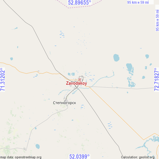
Zavodskoy GPS coordinates[2]
52° 28' 13.116" North, 72° 0' 54.504" East
| Map corner | latitude | longitude |
|---|---|---|
| Upper-left | 52.89655°, | 71.31202° |
| Center: | 52.47031°, | 72.01514° |
| Lower-right: | 52.0399°, | 72.71827° |
| Map W x H: | 95.3×95.2 km | = 59.2×59.2mi |
| max Lat: | 54.90596° ⇑13.3% North |
| Zavodskoy: | 52.47031° |
| min Lat: | ⇓86.7% South 40.66338° |
| min Long | Zavodskoy | max Long |
| 46.83361° | 72.01514° | 84.87144° |
| W 57.4%⇐ | ⇒42.6% E |
Elevation
Elevation of Zavodskoy is 264 m = 866 ft, and this is 92.5 m = 303 ft below average elevation for this country.
| Max E: |
1847 m = 6060 ft | 57% |
| Avg. | 356.5 m = 1170 ft | |
| Zavodskoy | 264 m = 866 ft | |
Min E: |
-26 m = -85 ft | 43% |
See also: Kazakhstan elevation on elevation.city.
Geographical zone
Zavodskoy is located in North temperate zone (between Tropic of Cancer and the Arctic Circle). Distance of this North polar circle is 1567 km =973.7 mi to North.| Distance of | km | miles | from Zavodskoy |
|---|---|---|---|
| North Pole | 4172.9 | 2592.9 | to North |
| Arctic Circle | 1567 | 973.7 | to North |
| Tropic Cancer | 3228.2 | 2005.9 | to South |
| Equator | 5834.2 | 3625.2 | to South |


Nearby cities:
15 places around Zavodskoy: (largest is in red/bold)
• Akkol
90 km =55.9 mi,  233°
233°
• Aksu
4.9 km =3 mi, 233°
• Astrakhan
184.3 km =114.5 mi,  235°
235°
• Bestobe
73.2 km =45.5 mi,  87°
87°
• Būrabay
133.2 km =82.8 mi,  300°
300°
• Kzyltu
131.4 km =81.6 mi,  9°
9°
• Makinsk
109.4 km =68 mi,  279°
279°
• Nur-Sultan
148.7 km =92.4 mi,  195°
195°
• Shchuchinsk
133.5 km =83 mi,  292°
292°
• Shortandy
110.5 km =68.7 mi,  219°
219°
• Stepnogorsk
16.1 km =10 mi,  214°
214°
• Stepnyak
92.1 km =57.2 mi, 296°
• Talshik
130.1 km =80.8 mi,  355°
355°
• Yermentau
120 km =74.6 mi,  141°
141°
• Zholymbet
83.6 km =51.9 mi,  194°
194°
Sources, notices
• [Note1] Compared only with cities in Kazakhstan existing in our database
• [Src1] Map data: © OpenStreetMap contributors (CC-BY-SA)
• [Src2] Other city data from geonames.org with taken over terms of usage.
• [Src3] Geographical zone / Annual Mean Temperature by Robert A. Rohde @ Wikipedia
