Bestobe geodata
Bestobe (Aqmola) is a populated place; located in Kazakhstan in Asia/Almaty (GMT+5) time zone. With population of 7,189 people, there are 151 cities with bigger population in this country. Compared to other cities in Kazakhstan, 87% of cities are located further ↓South; 64.8% of cities are located further ←West and 70.7% of cities have higher elevation than Bestobe. Note1


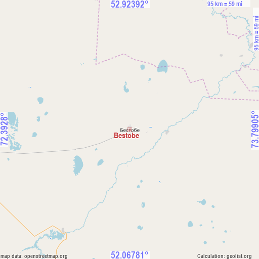
Bestobe GPS coordinates[2]
52° 29' 52.62" North, 73° 5' 45.312" East
| Map corner | latitude | longitude |
|---|---|---|
| Upper-left | 52.92392°, | 72.3928° |
| Center: | 52.49795°, | 73.09592° |
| Lower-right: | 52.06781°, | 73.79905° |
| Map W x H: | 95.2×95.2 km | = 59.2×59.2mi |
| max Lat: | 54.90596° ⇑13% North |
| Bestobe: | 52.49795° |
| min Lat: | ⇓87% South 40.66338° |
| min Long | Bestobe | max Long |
| 46.83361° | 73.09592° | 84.87144° |
| W 64.8%⇐ | ⇒35.2% E |
Elevation
Elevation of Bestobe is 174 m = 571 ft, and this is 182.5 m = 599 ft below average elevation for this country.
| Max E: |
1847 m = 6060 ft | 70.7% |
| Avg. | 356.5 m = 1170 ft | |
| Bestobe | 174 m = 571 ft | |
Min E: |
-26 m = -85 ft | 29.3% |
See also: Kazakhstan elevation on elevation.city.
Geographical zone
Bestobe is located in North temperate zone (between Tropic of Cancer and the Arctic Circle). Distance of this North polar circle is 1563.9 km =971.8 mi to North.| Distance of | km | miles | from Bestobe |
|---|---|---|---|
| North Pole | 4169.8 | 2591 | to North |
| Arctic Circle | 1563.9 | 971.8 | to North |
| Tropic Cancer | 3231.3 | 2007.8 | to South |
| Equator | 5837.2 | 3627.1 | to South |


Nearby cities:
15 places around Bestobe: (largest is in red/bold)
• Akkol
156.7 km =97.4 mi,  249°
249°
• Aksu
77.3 km =48 mi,  265°
265°
• Ekibastuz
174.7 km =108.6 mi,  119°
119°
• Irtyshsk
183.6 km =114.1 mi,  59°
59°
• Kzyltu
136.2 km =84.6 mi,  338°
338°
• Makinsk
181.5 km =112.8 mi, 274°
• Nur-Sultan
185.2 km =115.1 mi,  217°
217°
• Shortandy
168.8 km =104.9 mi,  238°
238°
• Stepnogorsk
83.9 km =52.1 mi,  258°
258°
• Stepnyak
160 km =99.4 mi,  283°
283°
• Talshik
150.7 km =93.6 mi,  327°
327°
• Yermentau
97.2 km =60.4 mi,  179°
179°
• Zavodskoy
73.2 km =45.5 mi, 267°
• Zhelezinka
188.1 km =116.9 mi,  52°
52°
• Zholymbet
126.4 km =78.5 mi,  228°
228°
Sources, notices
• [Note1] Compared only with cities in Kazakhstan existing in our database
• [Src1] Map data: © OpenStreetMap contributors (CC-BY-SA)
• [Src2] Other city data from geonames.org with taken over terms of usage.
• [Src3] Geographical zone / Annual Mean Temperature by Robert A. Rohde @ Wikipedia
