Qashyr geodata
Qashyr (Pavlodar Region) is a populated place; located in Kazakhstan in Asia/Almaty (GMT+5) time zone. With population of 8,931 people, there are 131 cities with bigger population in this country. Compared to other cities in Kazakhstan, 91.1% of cities are located further ↓South; 76.7% of cities are located further ←West and 84.1% of cities have higher elevation than Qashyr. Note1


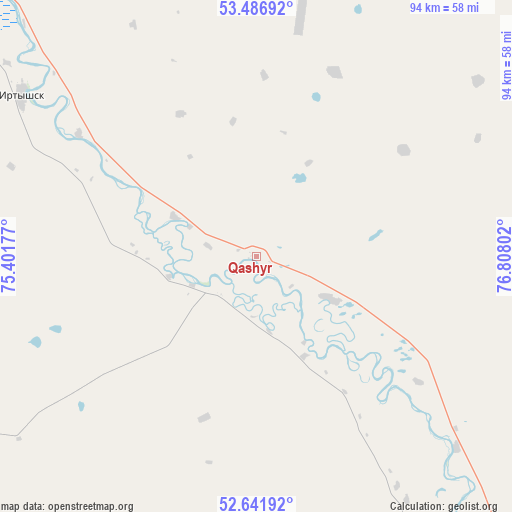
Qashyr GPS coordinates[2]
53° 3' 59.364" North, 76° 6' 17.604" East
| Map corner | latitude | longitude |
|---|---|---|
| Upper-left | 53.48692°, | 75.40177° |
| Center: | 53.06649°, | 76.10489° |
| Lower-right: | 52.64192°, | 76.80802° |
| Map W x H: | 94×94 km | = 58.4×58.4mi |
| max Lat: | 54.90596° ⇑8.9% North |
| Qashyr: | 53.06649° |
| min Lat: | ⇓91.1% South 40.66338° |
| min Long | Qashyr | max Long |
| 46.83361° | 76.10489° | 84.87144° |
| W 76.7%⇐ | ⇒23.3% E |
Elevation
Elevation of Qashyr is 97 m = 318 ft, and this is 259.5 m = 851 ft below average elevation for this country.
| Max E: |
1847 m = 6060 ft | 84.1% |
| Avg. | 356.5 m = 1170 ft | |
| Qashyr | 97 m = 318 ft | |
Min E: |
-26 m = -85 ft | 15.9% |
See also: Kazakhstan elevation on elevation.city.
Geographical zone
Qashyr is located in North temperate zone (between Tropic of Cancer and the Arctic Circle). Distance of this North polar circle is 1500.7 km =932.5 mi to North.| Distance of | km | miles | from Qashyr |
|---|---|---|---|
| North Pole | 4106.6 | 2551.7 | to North |
| Arctic Circle | 1500.7 | 932.5 | to North |
| Tropic Cancer | 3294.5 | 2047.1 | to South |
| Equator | 5900.4 | 3666.3 | to South |


Nearby cities:
15 places around Qashyr: (largest is in red/bold)
• Aksu
126.9 km =78.9 mi,  154°
154°
• Bayanaul
254.3 km =158 mi,  186°
186°
• Belogor’ye
194.5 km =120.9 mi, 151°
• Bestobe
212 km =131.7 mi,  252°
252°
• Ekibastuz
158.4 km =98.4 mi,  199°
199°
• Irtyshsk
52.3 km =32.5 mi,  304°
304°
• Kalkaman
123.9 km =77 mi,  182°
182°
• Kurchatov
306.4 km =190.4 mi, 146°
• Kushoky
366.3 km =227.6 mi,  210°
210°
• Kzyltu
257.7 km =160.1 mi,  284°
284°
• Leninskiy
101.3 km =62.9 mi, 153°
• Mayqayyng
179.8 km =111.7 mi, 186°
• Pavlodar
104.7 km =65.1 mi, 146°
• Yermentau
259.4 km =161.2 mi,  231°
231°
• Zhelezinka
74.3 km =46.2 mi,  314°
314°
Sources, notices
• [Note1] Compared only with cities in Kazakhstan existing in our database
• [Src1] Map data: © OpenStreetMap contributors (CC-BY-SA)
• [Src2] Other city data from geonames.org with taken over terms of usage.
• [Src3] Geographical zone / Annual Mean Temperature by Robert A. Rohde @ Wikipedia
