Stepnogorsk geodata
Stepnogorsk (Aqmola) is a populated place; located in Kazakhstan in Asia/Almaty (GMT+5) time zone. With population of 46,736 people, there are 30 cities with bigger population in this country. Compared to other cities in Kazakhstan, 84.8% of cities are located further ↓South; 56.7% of cities are located further ←West and 51.5% of cities have higher elevation than Stepnogorsk. Note1


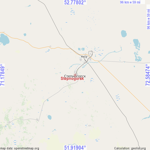
Stepnogorsk GPS coordinates[2]
52° 21' 2.232" North, 71° 52' 53.796" East
| Map corner | latitude | longitude |
|---|---|---|
| Upper-left | 52.77802°, | 71.17849° |
| Center: | 52.35062°, | 71.88161° |
| Lower-right: | 51.91904°, | 72.58474° |
| Map W x H: | 95.5×95.5 km | = 59.3×59.3mi |
| max Lat: | 54.90596° ⇑15.2% North |
| Stepnogorsk: | 52.35062° |
| min Lat: | ⇓84.8% South 40.66338° |
| min Long | Stepnogorsk | max Long |
| 46.83361° | 71.88161° | 84.87144° |
| W 56.7%⇐ | ⇒43.3% E |
Elevation
Elevation of Stepnogorsk is 311 m = 1020 ft, and this is 45.5 m = 149 ft below average elevation for this country.
| Max E: |
1847 m = 6060 ft | 51.5% |
| Avg. | 356.5 m = 1170 ft | |
| Stepnogorsk | 311 m = 1020 ft | |
Min E: |
-26 m = -85 ft | 48.5% |
See also: Stepnogorsk elevation on elevation.city.
Geographical zone
Stepnogorsk is located in North temperate zone (between Tropic of Cancer and the Arctic Circle). Distance of this North polar circle is 1580.3 km =982 mi to North.| Distance of | km | miles | from Stepnogorsk |
|---|---|---|---|
| North Pole | 4186.2 | 2601.2 | to North |
| Arctic Circle | 1580.3 | 982 | to North |
| Tropic Cancer | 3214.9 | 1997.6 | to South |
| Equator | 5820.8 | 3616.9 | to South |


Nearby cities:
15 places around Stepnogorsk: (largest is in red/bold)
• Akkol
75.1 km =46.7 mi,  238°
238°
• Aksu
11.6 km =7.2 mi,  26°
26°
• Astrakhan
169.5 km =105.3 mi, 237°
• Bestobe
83.9 km =52.1 mi,  78°
78°
• Būrabay
133.4 km =82.9 mi,  307°
307°
• Kzyltu
146.2 km =90.8 mi,  12°
12°
• Makinsk
103.9 km =64.6 mi,  287°
287°
• Nur-Sultan
133.6 km =83 mi,  192°
192°
• Shchuchinsk
131.4 km =81.6 mi,  299°
299°
• Shortandy
94.5 km =58.7 mi,  219°
219°
• Stepnyak
91.4 km =56.8 mi, 306°
• Talshik
143.1 km =88.9 mi,  359°
359°
• Yermentau
116.3 km =72.3 mi,  134°
134°
• Zavodskoy
16.1 km =10 mi, 34°
• Zholymbet
68.6 km =42.6 mi, 189°
Sources, notices
• [Note1] Compared only with cities in Kazakhstan existing in our database
• [Src1] Map data: © OpenStreetMap contributors (CC-BY-SA)
• [Src2] Other city data from geonames.org with taken over terms of usage.
• [Src3] Geographical zone / Annual Mean Temperature by Robert A. Rohde @ Wikipedia
