Talshik geodata
Talshik (Soltüstik Qazaqstan) is a populated place; located in Kazakhstan in Asia/Almaty (GMT+5) time zone. With population of 3,111 people, there are 227 cities with bigger population in this country. Compared to other cities in Kazakhstan, 95.6% of cities are located further ↓South; 56.3% of cities are located further ←West and 85.9% of cities have higher elevation than Talshik. Note1


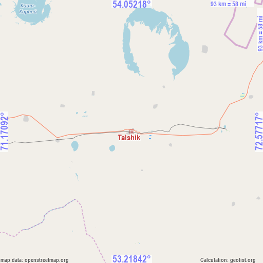
Talshik GPS coordinates[2]
53° 38' 14.496" North, 71° 52' 26.544" East
| Map corner | latitude | longitude |
|---|---|---|
| Upper-left | 54.05218°, | 71.17092° |
| Center: | 53.63736°, | 71.87404° |
| Lower-right: | 53.21842°, | 72.57717° |
| Map W x H: | 92.7×92.7 km | = 57.6×57.6mi |
| max Lat: | 54.90596° ⇑4.4% North |
| Talshik: | 53.63736° |
| min Lat: | ⇓95.6% South 40.66338° |
| min Long | Talshik | max Long |
| 46.83361° | 71.87404° | 84.87144° |
| W 56.3%⇐ | ⇒43.7% E |
Elevation
Elevation of Talshik is 75 m = 246 ft, and this is 281.5 m = 924 ft below average elevation for this country.
| Max E: |
1847 m = 6060 ft | 85.9% |
| Avg. | 356.5 m = 1170 ft | |
| Talshik | 75 m = 246 ft | |
Min E: |
-26 m = -85 ft | 14.1% |
See also: Kazakhstan elevation on elevation.city.
Geographical zone
Talshik is located in North temperate zone (between Tropic of Cancer and the Arctic Circle). Distance of this North polar circle is 1437.3 km =893.1 mi to North.| Distance of | km | miles | from Talshik |
|---|---|---|---|
| North Pole | 4043.1 | 2512.3 | to North |
| Arctic Circle | 1437.3 | 893.1 | to North |
| Tropic Cancer | 3358 | 2086.6 | to South |
| Equator | 5963.9 | 3705.8 | to South |


Nearby cities:
15 places around Talshik: (largest is in red/bold)
• Akkol
193.1 km =120 mi,  198°
198°
• Akkol’
155.2 km =96.4 mi,  255°
255°
• Aksu
132.8 km =82.5 mi,  177°
177°
• Bestobe
150.7 km =93.6 mi,  147°
147°
• Bulayevo
169 km =105 mi,  326°
326°
• Būrabay
120.4 km =74.8 mi,  239°
239°
• Kokshetau
168.4 km =104.6 mi, 256°
• Kzyltu
30.8 km =19.1 mi,  90°
90°
• Makinsk
148 km =92 mi,  220°
220°
• Shchuchinsk
136.5 km =84.8 mi, 235°
• Smirnovo
187.1 km =116.3 mi,  301°
301°
• Stepnogorsk
143.1 km =88.9 mi, 179°
• Stepnyak
114.8 km =71.3 mi, 218°
• Taiynsha
140.5 km =87.3 mi,  279°
279°
• Zavodskoy
130.1 km =80.8 mi, 175°
Sources, notices
• [Note1] Compared only with cities in Kazakhstan existing in our database
• [Src1] Map data: © OpenStreetMap contributors (CC-BY-SA)
• [Src2] Other city data from geonames.org with taken over terms of usage.
• [Src3] Geographical zone / Annual Mean Temperature by Robert A. Rohde @ Wikipedia
