Zhangatas geodata
Zhangatas (Zhambyl) is a populated place; located in Kazakhstan in Asia/Almaty (GMT+5) time zone. With population of 33,492 people, there are 48 cities with bigger population in this country. Compared to other cities in Kazakhstan, 83% of cities are located further ↑North; 54.4% of cities are located further →East and 75.9% of cities have lower elevation than Zhangatas. Note1


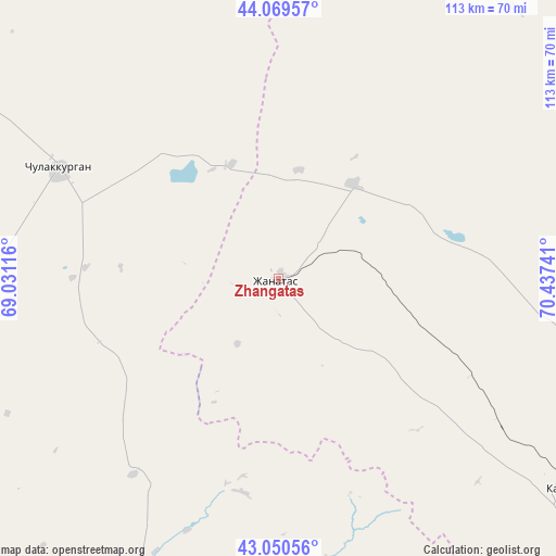
Zhangatas GPS coordinates[2]
43° 33' 43.992" North, 69° 44' 3.408" East
| Map corner | latitude | longitude |
|---|---|---|
| Upper-left | 44.06957°, | 69.03116° |
| Center: | 43.56222°, | 69.73428° |
| Lower-right: | 43.05056°, | 70.43741° |
| Map W x H: | 113.3×113.3 km | = 70.4×70.4mi |
| max Lat: | 54.90596° ⇑83% North |
| Zhangatas: | 43.56222° |
| min Lat: | ⇓17% South 40.66338° |
| min Long | Zhangatas | max Long |
| 46.83361° | 69.73428° | 84.87144° |
| W 45.6%⇐ | ⇒54.4% E |
Elevation
Elevation of Zhangatas is 511 m = 1677 ft, and this is 154.5 m = 507 ft above average elevation for this country.
| Max E: |
1847 m = 6060 ft | 24.1% |
| Zhangatas | 511 m 1677 ft | |
| Avg. | 356.5 m = 1170 ft | |
Min E: |
-26 m = -85 ft | 75.9% |
See also: Kazakhstan elevation on elevation.city.
Geographical zone
Zhangatas is located in North temperate zone (between Tropic of Cancer and the Arctic Circle). Distance of this Northern Tropic circle is 2237.7 km =1390.4 mi to South.| Distance of | km | miles | from Zhangatas |
|---|---|---|---|
| North Pole | 5163.4 | 3208.4 | to North |
| Arctic Circle | 2557.5 | 1589.2 | to North |
| Tropic Cancer | 2237.7 | 1390.4 | to South |
| Equator | 4843.7 | 3009.7 | to South |


Nearby cities:
15 places around Zhangatas: (largest is in red/bold)
• Ashchysay
67.4 km =41.9 mi,  269°
269°
• Bayzhansay
46.3 km =28.8 mi,  161°
161°
• Belyye Vody
127 km =78.9 mi,  176°
176°
• Chayan
65.3 km =40.6 mi,  205°
205°
• Chulakkurgan
50 km =31.1 mi,  296°
296°
• Kantagi
92.9 km =57.7 mi, 267°
• Karatau
73 km =45.4 mi,  125°
125°
• Kentau
99.2 km =61.6 mi, 267°
• Kokterek
126 km =78.3 mi, 160°
• Sastobe
114.2 km =71 mi,  169°
169°
• Temirlanovka
113.8 km =70.7 mi,  199°
199°
• Turar Ryskulov
124.8 km =77.5 mi, 156°
• Turkestan
123.3 km =76.6 mi,  256°
256°
• Tyul’kubas
128.1 km =79.6 mi, 159°
• Zhabagly
138.9 km =86.3 mi,  154°
154°
Sources, notices
• [Note1] Compared only with cities in Kazakhstan existing in our database
• [Src1] Map data: © OpenStreetMap contributors (CC-BY-SA)
• [Src2] Other city data from geonames.org with taken over terms of usage.
• [Src3] Geographical zone / Annual Mean Temperature by Robert A. Rohde @ Wikipedia
