Belyye Vody geodata
Belyye Vody (South Kazakhstan) is a populated place; located in Kazakhstan in Asia/Almaty (GMT+5) time zone. With population of 26,115 people, there are 57 cities with bigger population in this country. Compared to other cities in Kazakhstan, 96.7% of cities are located further ↑North; 53% of cities are located further →East and 83.3% of cities have lower elevation than Belyye Vody. Note1


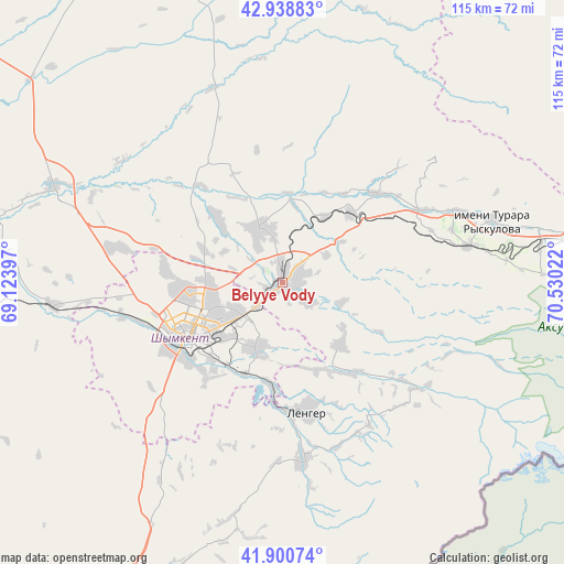
Belyye Vody GPS coordinates[2]
42° 25' 18.948" North, 69° 49' 37.524" East
| Map corner | latitude | longitude |
|---|---|---|
| Upper-left | 42.93883°, | 69.12397° |
| Center: | 42.42193°, | 69.82709° |
| Lower-right: | 41.90074°, | 70.53022° |
| Map W x H: | 115.4×115.4 km | = 71.7×71.7mi |
| max Lat: | 54.90596° ⇑96.7% North |
| Belyye Vody: | 42.42193° |
| min Lat: | ⇓3.3% South 40.66338° |
| min Long | Belyye Vody | max Long |
| 46.83361° | 69.82709° | 84.87144° |
| W 47%⇐ | ⇒53% E |
Elevation
Elevation of Belyye Vody is 614 m = 2014 ft, and this is 257.5 m = 845 ft above average elevation for this country.
| Max E: |
1847 m = 6060 ft | 16.7% |
| Belyye Vody | 614 m 2014 ft | |
| Avg. | 356.5 m = 1170 ft | |
Min E: |
-26 m = -85 ft | 83.3% |
See also: Kazakhstan elevation on elevation.city.
Geographical zone
Belyye Vody is located in North temperate zone (between Tropic of Cancer and the Arctic Circle). Distance of this Northern Tropic circle is 2111 km =1311.7 mi to South.| Distance of | km | miles | from Belyye Vody |
|---|---|---|---|
| North Pole | 5290.2 | 3287.2 | to North |
| Arctic Circle | 2684.3 | 1667.9 | to North |
| Tropic Cancer | 2111 | 1311.7 | to South |
| Equator | 4716.9 | 2930.9 | to South |


Nearby cities:
15 places around Belyye Vody: (largest is in red/bold)
• Arys
83.6 km =51.9 mi,  270°
270°
• Bayzhansay
83.2 km =51.7 mi,  4°
4°
• Chayan
77.2 km =48 mi,  331°
331°
• Karatau
99.1 km =61.6 mi,  31°
31°
• Kokterek
36 km =22.4 mi,  77°
77°
• Lenger
27.2 km =16.9 mi,  169°
169°
• Leninskoye
82.5 km =51.3 mi,  206°
206°
• Saryaghash
120 km =74.6 mi, 207°
• Sastobe
20.3 km =12.6 mi,  43°
43°
• Sayram
14.5 km =9 mi,  203°
203°
• Shymkent
23.1 km =14.4 mi,  233°
233°
• Temirlanovka
50.6 km =31.4 mi,  293°
293°
• Turar Ryskulov
44.6 km =27.7 mi,  73°
73°
• Tyul’kubas
39.1 km =24.3 mi, 79°
• Zhabagly
53.5 km =33.2 mi,  88°
88°
Sources, notices
• [Note1] Compared only with cities in Kazakhstan existing in our database
• [Src1] Map data: © OpenStreetMap contributors (CC-BY-SA)
• [Src2] Other city data from geonames.org with taken over terms of usage.
• [Src3] Geographical zone / Annual Mean Temperature by Robert A. Rohde @ Wikipedia
