Tyul’kubas geodata
Tyul’kubas (South Kazakhstan) is a populated place; located in Kazakhstan in Asia/Almaty (GMT+5) time zone. With population of 10,802 people, there are 107 cities with bigger population in this country. Compared to other cities in Kazakhstan, 95.6% of cities are located further ↑North; 50.4% of cities are located further →East and 95.6% of cities have lower elevation than Tyul’kubas. Note1


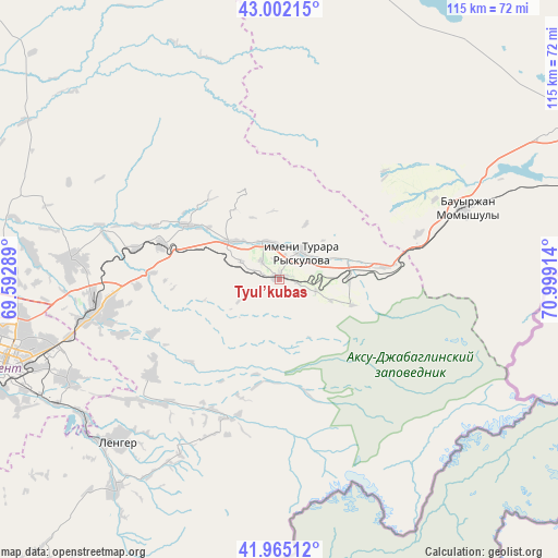
Tyul’kubas GPS coordinates[2]
42° 29' 8.808" North, 70° 17' 45.636" East
| Map corner | latitude | longitude |
|---|---|---|
| Upper-left | 43.00215°, | 69.59289° |
| Center: | 42.48578°, | 70.29601° |
| Lower-right: | 41.96512°, | 70.99914° |
| Map W x H: | 115.3×115.3 km | = 71.6×71.6mi |
| max Lat: | 54.90596° ⇑95.6% North |
| Tyul’kubas: | 42.48578° |
| min Lat: | ⇓4.4% South 40.66338° |
| min Long | Tyul’kubas | max Long |
| 46.83361° | 70.29601° | 84.87144° |
| W 49.6%⇐ | ⇒50.4% E |
Elevation
Elevation of Tyul’kubas is 823 m = 2700 ft, and this is 466.5 m = 1531 ft above average elevation for this country.
| Max E: |
1847 m = 6060 ft | 4.4% |
| Tyul’kubas | 823 m 2700 ft | |
| Avg. | 356.5 m = 1170 ft | |
Min E: |
-26 m = -85 ft | 95.6% |
See also: Kazakhstan elevation on elevation.city.
Geographical zone
Tyul’kubas is located in North temperate zone (between Tropic of Cancer and the Arctic Circle). Distance of this Northern Tropic circle is 2118.1 km =1316.1 mi to South.| Distance of | km | miles | from Tyul’kubas |
|---|---|---|---|
| North Pole | 5283.1 | 3282.8 | to North |
| Arctic Circle | 2677.2 | 1663.5 | to North |
| Tropic Cancer | 2118.1 | 1316.1 | to South |
| Equator | 4724 | 2935.4 | to South |


Nearby cities:
15 places around Tyul’kubas: (largest is in red/bold)
• Bayzhansay
81.9 km =50.9 mi,  337°
337°
• Belyye Vody
39.1 km =24.3 mi,  259°
259°
• Chayan
96.4 km =59.9 mi,  309°
309°
• Karatau
78.3 km =48.7 mi,  10°
10°
• Kokterek
3.5 km =2.2 mi,  285°
285°
• Lenger
47.8 km =29.7 mi,  224°
224°
• Leninskoye
110.6 km =68.7 mi, 222°
• Sarykemer
113.7 km =70.6 mi,  59°
59°
• Sastobe
25.5 km =15.8 mi, 287°
• Sayram
48.7 km =30.3 mi,  245°
245°
• Shymkent
60.8 km =37.8 mi, 250°
• Taraz
98.9 km =61.5 mi, 62°
• Temirlanovka
85.9 km =53.4 mi,  278°
278°
• Turar Ryskulov
6.9 km =4.3 mi,  39°
39°
• Zhabagly
15.9 km =9.9 mi,  109°
109°
Sources, notices
• [Note1] Compared only with cities in Kazakhstan existing in our database
• [Src1] Map data: © OpenStreetMap contributors (CC-BY-SA)
• [Src2] Other city data from geonames.org with taken over terms of usage.
• [Src3] Geographical zone / Annual Mean Temperature by Robert A. Rohde @ Wikipedia
