Turkestan geodata
Turkestan (South Kazakhstan) is a seat of a first-order administrative division; located in Kazakhstan in Asia/Almaty (GMT+5) time zone. With population of 97,360 people, there are 22 cities with bigger population in this country. Compared to other cities in Kazakhstan, 87.8% of cities are located further ↑North; 64.4% of cities are located further →East and 63% of cities have higher elevation than Turkestan. Note1


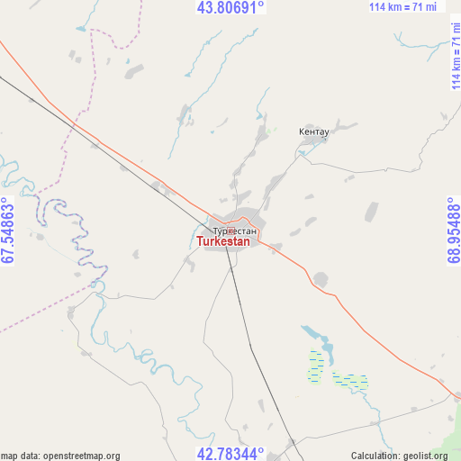
Turkestan GPS coordinates[2]
43° 17' 50.388" North, 68° 15' 6.3" East
| Map corner | latitude | longitude |
|---|---|---|
| Upper-left | 43.80691°, | 67.54863° |
| Center: | 43.29733°, | 68.25175° |
| Lower-right: | 42.78344°, | 68.95488° |
| Map W x H: | 113.8×113.8 km | = 70.7×70.7mi |
| max Lat: | 54.90596° ⇑87.8% North |
| Turkestan: | 43.29733° |
| min Lat: | ⇓12.2% South 40.66338° |
| min Long | Turkestan | max Long |
| 46.83361° | 68.25175° | 84.87144° |
| W 35.6%⇐ | ⇒64.4% E |
Elevation
Elevation of Turkestan is 214 m = 702 ft, and this is 142.5 m = 468 ft below average elevation for this country.
| Max E: |
1847 m = 6060 ft | 63% |
| Avg. | 356.5 m = 1170 ft | |
| Turkestan | 214 m = 702 ft | |
Min E: |
-26 m = -85 ft | 37% |
See also: Turkestan elevation on elevation.city.
Geographical zone
Turkestan is located in North temperate zone (between Tropic of Cancer and the Arctic Circle). Distance of this Northern Tropic circle is 2208.3 km =1372.2 mi to South.| Distance of | km | miles | from Turkestan |
|---|---|---|---|
| North Pole | 5192.9 | 3226.7 | to North |
| Arctic Circle | 2587 | 1607.5 | to North |
| Tropic Cancer | 2208.3 | 1372.2 | to South |
| Equator | 4814.2 | 2991.4 | to South |


Nearby cities:
15 places around Turkestan: (largest is in red/bold)
• Arys
106.6 km =66.2 mi,  154°
154°
• Ashchysay
59.5 km =37 mi,  61°
61°
• Bayzhansay
135.5 km =84.2 mi,  96°
96°
• Belyye Vody
161.1 km =100.1 mi,  127°
127°
• Chayan
96.1 km =59.7 mi,  107°
107°
• Chulakkurgan
91 km =56.5 mi, 55°
• Kantagi
37 km =23 mi,  46°
46°
• Kentau
31.8 km =19.8 mi,  39°
39°
• Qogham
52.3 km =32.5 mi,  177°
177°
• Shalqīya
104.2 km =64.7 mi,  319°
319°
• Shymkent
156.2 km =97.1 mi,  135°
135°
• Shīeli
155.4 km =96.6 mi,  308°
308°
• Temirlanovka
112.8 km =70.1 mi, 133°
• Yanykurgan
105.6 km =65.6 mi, 309°
• Zhangatas
123.3 km =76.6 mi,  76°
76°
Sources, notices
• [Note1] Compared only with cities in Kazakhstan existing in our database
• [Src1] Map data: © OpenStreetMap contributors (CC-BY-SA)
• [Src2] Other city data from geonames.org with taken over terms of usage.
• [Src3] Geographical zone / Annual Mean Temperature by Robert A. Rohde @ Wikipedia
