Chayan geodata
Chayan (South Kazakhstan) is a populated place; located in Kazakhstan in Asia/Almaty (GMT+5) time zone. With population of 9,536 people, there are 125 cities with bigger population in this country. Compared to other cities in Kazakhstan, 90% of cities are located further ↑North; 57% of cities are located further →East and 58.9% of cities have lower elevation than Chayan. Note1


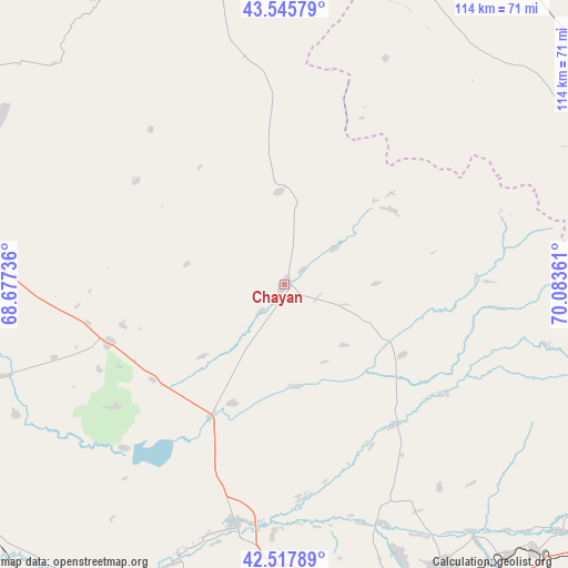
Chayan GPS coordinates[2]
43° 2' 2.364" North, 69° 22' 49.728" East
| Map corner | latitude | longitude |
|---|---|---|
| Upper-left | 43.54579°, | 68.67736° |
| Center: | 43.03399°, | 69.38048° |
| Lower-right: | 42.51789°, | 70.08361° |
| Map W x H: | 114.3×114.3 km | = 71×71mi |
| max Lat: | 54.90596° ⇑90% North |
| Chayan: | 43.03399° |
| min Lat: | ⇓10% South 40.66338° |
| min Long | Chayan | max Long |
| 46.83361° | 69.38048° | 84.87144° |
| W 43%⇐ | ⇒57% E |
Elevation
Elevation of Chayan is 381 m = 1250 ft, and this is 24.5 m = 80 ft above average elevation for this country.
| Max E: |
1847 m = 6060 ft | 41.1% |
| Chayan | 381 m 1250 ft | |
| Avg. | 356.5 m = 1170 ft | |
Min E: |
-26 m = -85 ft | 58.9% |
See also: Kazakhstan elevation on elevation.city.
Geographical zone
Chayan is located in North temperate zone (between Tropic of Cancer and the Arctic Circle). Distance of this Northern Tropic circle is 2179 km =1354 mi to South.| Distance of | km | miles | from Chayan |
|---|---|---|---|
| North Pole | 5222.1 | 3244.9 | to North |
| Arctic Circle | 2616.2 | 1625.6 | to North |
| Tropic Cancer | 2179 | 1354 | to South |
| Equator | 4784.9 | 2973.2 | to South |


Nearby cities:
15 places around Chayan: (largest is in red/bold)
• Arys
81.8 km =50.8 mi,  214°
214°
• Ashchysay
69.7 km =43.3 mi,  325°
325°
• Bayzhansay
45.8 km =28.5 mi,  71°
71°
• Belyye Vody
77.2 km =48 mi,  151°
151°
• Chulakkurgan
82.9 km =51.5 mi,  348°
348°
• Kantagi
84.8 km =52.7 mi,  310°
310°
• Karatau
89.7 km =55.7 mi,  79°
79°
• Kentau
88.9 km =55.2 mi, 307°
• Kokterek
93.2 km =57.9 mi,  130°
130°
• Qogham
92.4 km =57.4 mi,  255°
255°
• Sastobe
73.5 km =45.7 mi,  136°
136°
• Sayram
87 km =54.1 mi,  159°
159°
• Shymkent
83.6 km =51.9 mi,  167°
167°
• Temirlanovka
49.3 km =30.6 mi,  191°
191°
• Zhangatas
65.3 km =40.6 mi,  25°
25°
Sources, notices
• [Note1] Compared only with cities in Kazakhstan existing in our database
• [Src1] Map data: © OpenStreetMap contributors (CC-BY-SA)
• [Src2] Other city data from geonames.org with taken over terms of usage.
• [Src3] Geographical zone / Annual Mean Temperature by Robert A. Rohde @ Wikipedia
