Temirlanovka geodata
Temirlanovka (South Kazakhstan) is a populated place; located in Kazakhstan in Asia/Almaty (GMT+5) time zone. With population of 12,245 people, there are 97 cities with bigger population in this country. Compared to other cities in Kazakhstan, 94.1% of cities are located further ↑North; 57.4% of cities are located further →East and 53.3% of cities have higher elevation than Temirlanovka. Note1


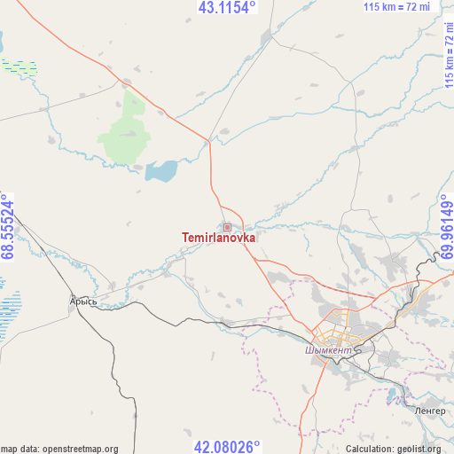
Temirlanovka GPS coordinates[2]
42° 35' 59.928" North, 69° 15' 30.096" East
| Map corner | latitude | longitude |
|---|---|---|
| Upper-left | 43.1154°, | 68.55524° |
| Center: | 42.59998°, | 69.25836° |
| Lower-right: | 42.08026°, | 69.96149° |
| Map W x H: | 115.1×115.1 km | = 71.5×71.5mi |
| max Lat: | 54.90596° ⇑94.1% North |
| Temirlanovka: | 42.59998° |
| min Lat: | ⇓5.9% South 40.66338° |
| min Long | Temirlanovka | max Long |
| 46.83361° | 69.25836° | 84.87144° |
| W 42.6%⇐ | ⇒57.4% E |
Elevation
Elevation of Temirlanovka is 291 m = 955 ft, and this is 65.5 m = 215 ft below average elevation for this country.
| Max E: |
1847 m = 6060 ft | 53.3% |
| Avg. | 356.5 m = 1170 ft | |
| Temirlanovka | 291 m = 955 ft | |
Min E: |
-26 m = -85 ft | 46.7% |
See also: Kazakhstan elevation on elevation.city.
Geographical zone
Temirlanovka is located in North temperate zone (between Tropic of Cancer and the Arctic Circle). Distance of this Northern Tropic circle is 2130.8 km =1324 mi to South.| Distance of | km | miles | from Temirlanovka |
|---|---|---|---|
| North Pole | 5270.4 | 3274.9 | to North |
| Arctic Circle | 2664.5 | 1655.6 | to North |
| Tropic Cancer | 2130.8 | 1324 | to South |
| Equator | 4736.7 | 2943.2 | to South |


Nearby cities:
15 places around Temirlanovka: (largest is in red/bold)
• Arys
41.4 km =25.7 mi,  242°
242°
• Ashchysay
110 km =68.4 mi,  344°
344°
• Bayzhansay
82.7 km =51.4 mi,  40°
40°
• Belyye Vody
50.6 km =31.4 mi,  113°
113°
• Chayan
49.3 km =30.6 mi,  11°
11°
• Kokterek
82.5 km =51.3 mi,  98°
98°
• Lenger
69.4 km =43.1 mi,  132°
132°
• Leninskoye
94.4 km =58.7 mi,  173°
173°
• Qogham
83.8 km =52.1 mi,  287°
287°
• Sastobe
60.8 km =37.8 mi,  94°
94°
• Sayram
52.6 km =32.7 mi, 128°
• Shymkent
43.6 km =27.1 mi,  139°
139°
• Turar Ryskulov
89.7 km =55.7 mi, 94°
• Tyul’kubas
85.9 km =53.4 mi, 98°
• Zhabagly
101.6 km =63.1 mi, 100°
Sources, notices
• [Note1] Compared only with cities in Kazakhstan existing in our database
• [Src1] Map data: © OpenStreetMap contributors (CC-BY-SA)
• [Src2] Other city data from geonames.org with taken over terms of usage.
• [Src3] Geographical zone / Annual Mean Temperature by Robert A. Rohde @ Wikipedia
