Kantagi geodata
Kantagi (South Kazakhstan) is a section of populated place; located in Kazakhstan in Asia/Almaty (GMT+5) time zone. With population of 10,186 people, there are 111 cities with bigger population in this country. Compared to other cities in Kazakhstan, 83.7% of cities are located further ↑North; 60.7% of cities are located further →East and 69.3% of cities have lower elevation than Kantagi. Note1


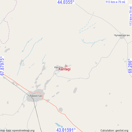
Kantagi GPS coordinates[2]
43° 31' 40.296" North, 68° 34' 58.332" East
| Map corner | latitude | longitude |
|---|---|---|
| Upper-left | 44.0355°, | 67.87975° |
| Center: | 43.52786°, | 68.58287° |
| Lower-right: | 43.01591°, | 69.286° |
| Map W x H: | 113.4×113.4 km | = 70.5×70.5mi |
| max Lat: | 54.90596° ⇑83.7% North |
| Kantagi: | 43.52786° |
| min Lat: | ⇓16.3% South 40.66338° |
| min Long | Kantagi | max Long |
| 46.83361° | 68.58287° | 84.87144° |
| W 39.3%⇐ | ⇒60.7% E |
Elevation
Elevation of Kantagi is 470 m = 1542 ft, and this is 113.5 m = 372 ft above average elevation for this country.
| Max E: |
1847 m = 6060 ft | 30.7% |
| Kantagi | 470 m 1542 ft | |
| Avg. | 356.5 m = 1170 ft | |
Min E: |
-26 m = -85 ft | 69.3% |
See also: Kazakhstan elevation on elevation.city.
Geographical zone
Kantagi is located in North temperate zone (between Tropic of Cancer and the Arctic Circle). Distance of this Northern Tropic circle is 2233.9 km =1388.1 mi to South.| Distance of | km | miles | from Kantagi |
|---|---|---|---|
| North Pole | 5167.2 | 3210.7 | to North |
| Arctic Circle | 2561.3 | 1591.5 | to North |
| Tropic Cancer | 2233.9 | 1388.1 | to South |
| Equator | 4839.8 | 3007.3 | to South |


Nearby cities:
15 places around Kantagi: (largest is in red/bold)
• Arys
123.4 km =76.7 mi,  171°
171°
• Ashchysay
25.6 km =15.9 mi,  83°
83°
• Bayzhansay
114.9 km =71.4 mi,  110°
110°
• Belyye Vody
159.3 km =99 mi,  140°
140°
• Chayan
84.8 km =52.7 mi,  130°
130°
• Chulakkurgan
54.7 km =34 mi,  61°
61°
• Karatau
157.3 km =97.7 mi,  104°
104°
• Kentau
6.4 km =4 mi,  258°
258°
• Qogham
81.6 km =50.7 mi,  197°
197°
• Sastobe
158 km =98.2 mi, 133°
• Shalqīya
108.3 km =67.3 mi,  299°
299°
• Temirlanovka
116.9 km =72.6 mi,  151°
151°
• Turkestan
37 km =23 mi,  226°
226°
• Yanykurgan
115.4 km =71.7 mi,  291°
291°
• Zhangatas
92.9 km =57.7 mi,  87°
87°
Sources, notices
• [Note1] Compared only with cities in Kazakhstan existing in our database
• [Src1] Map data: © OpenStreetMap contributors (CC-BY-SA)
• [Src2] Other city data from geonames.org with taken over terms of usage.
• [Src3] Geographical zone / Annual Mean Temperature by Robert A. Rohde @ Wikipedia
