Zhabagly geodata
Zhabagly (South Kazakhstan) is a populated place; located in Kazakhstan in Asia/Almaty (GMT+5) time zone. With population of 2,000 people, there are 246 cities with bigger population in this country. Compared to other cities in Kazakhstan, 95.9% of cities are located further ↑North; 51.9% of cities are located further ←West and 98.9% of cities have lower elevation than Zhabagly. Note1


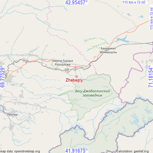
Zhabagly GPS coordinates[2]
42° 26' 16.116" North, 70° 28' 42.276" East
| Map corner | latitude | longitude |
|---|---|---|
| Upper-left | 42.95457°, | 69.77529° |
| Center: | 42.43781°, | 70.47841° |
| Lower-right: | 41.91675°, | 71.18154° |
| Map W x H: | 115.4×115.4 km | = 71.7×71.7mi |
| max Lat: | 54.90596° ⇑95.9% North |
| Zhabagly: | 42.43781° |
| min Lat: | ⇓4.1% South 40.66338° |
| min Long | Zhabagly | max Long |
| 46.83361° | 70.47841° | 84.87144° |
| W 51.9%⇐ | ⇒48.1% E |
Elevation
Elevation of Zhabagly is 1122 m = 3681 ft, and this is 765.5 m = 2511 ft above average elevation for this country.
| Max E: |
1847 m = 6060 ft | 1.1% |
| Zhabagly | 1122 m 3681 ft | |
| Avg. | 356.5 m = 1170 ft | |
Min E: |
-26 m = -85 ft | 98.9% |
See also: Kazakhstan elevation on elevation.city.
Geographical zone
Zhabagly is located in North temperate zone (between Tropic of Cancer and the Arctic Circle). Distance of this Northern Tropic circle is 2112.7 km =1312.8 mi to South.| Distance of | km | miles | from Zhabagly |
|---|---|---|---|
| North Pole | 5288.4 | 3286.1 | to North |
| Arctic Circle | 2682.5 | 1666.8 | to North |
| Tropic Cancer | 2112.7 | 1312.8 | to South |
| Equator | 4718.6 | 2932 | to South |


Nearby cities:
15 places around Zhabagly: (largest is in red/bold)
• Bayzhansay
93.2 km =57.9 mi,  330°
330°
• Belyye Vody
53.5 km =33.2 mi,  268°
268°
• Chayan
111.5 km =69.3 mi,  306°
306°
• Karatau
82.4 km =51.2 mi,  359°
359°
• Kokterek
19.4 km =12.1 mi,  288°
288°
• Lenger
56.4 km =35 mi,  239°
239°
• Leninskoye
117.9 km =73.3 mi,  230°
230°
• Sarykemer
104.3 km =64.8 mi,  53°
53°
• Sastobe
41.4 km =25.7 mi, 288°
• Sayram
61.1 km =38 mi,  255°
255°
• Shymkent
73.8 km =45.9 mi, 258°
• Taraz
89 km =55.3 mi, 54°
• Temirlanovka
101.6 km =63.1 mi,  280°
280°
• Turar Ryskulov
15 km =9.3 mi,  315°
315°
• Tyul’kubas
15.9 km =9.9 mi, 289°
Sources, notices
• [Note1] Compared only with cities in Kazakhstan existing in our database
• [Src1] Map data: © OpenStreetMap contributors (CC-BY-SA)
• [Src2] Other city data from geonames.org with taken over terms of usage.
• [Src3] Geographical zone / Annual Mean Temperature by Robert A. Rohde @ Wikipedia
