Ashchysay geodata
Ashchysay (South Kazakhstan) is a populated place; located in Kazakhstan in Asia/Almaty (GMT+5) time zone. With population of 5,635 people, there are 180 cities with bigger population in this country. Compared to other cities in Kazakhstan, 83.3% of cities are located further ↑North; 59.3% of cities are located further →East and 95.2% of cities have lower elevation than Ashchysay. Note1


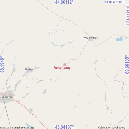
Ashchysay GPS coordinates[2]
43° 33' 13.32" North, 68° 53' 52.512" East
| Map corner | latitude | longitude |
|---|---|---|
| Upper-left | 44.06112°, | 68.1948° |
| Center: | 43.5537°, | 68.89792° |
| Lower-right: | 43.04197°, | 69.60105° |
| Map W x H: | 113.3×113.3 km | = 70.4×70.4mi |
| max Lat: | 54.90596° ⇑83.3% North |
| Ashchysay: | 43.5537° |
| min Lat: | ⇓16.7% South 40.66338° |
| min Long | Ashchysay | max Long |
| 46.83361° | 68.89792° | 84.87144° |
| W 40.7%⇐ | ⇒59.3% E |
Elevation
Elevation of Ashchysay is 816 m = 2677 ft, and this is 459.5 m = 1508 ft above average elevation for this country.
| Max E: |
1847 m = 6060 ft | 4.8% |
| Ashchysay | 816 m 2677 ft | |
| Avg. | 356.5 m = 1170 ft | |
Min E: |
-26 m = -85 ft | 95.2% |
See also: Kazakhstan elevation on elevation.city.
Geographical zone
Ashchysay is located in North temperate zone (between Tropic of Cancer and the Arctic Circle). Distance of this Northern Tropic circle is 2236.8 km =1389.9 mi to South.| Distance of | km | miles | from Ashchysay |
|---|---|---|---|
| North Pole | 5164.3 | 3208.9 | to North |
| Arctic Circle | 2558.5 | 1589.8 | to North |
| Tropic Cancer | 2236.8 | 1389.9 | to South |
| Equator | 4842.7 | 3009.1 | to South |


Nearby cities:
15 places around Ashchysay: (largest is in red/bold)
• Arys
125.1 km =77.7 mi,  183°
183°
• Bayzhansay
92.8 km =57.7 mi,  117°
117°
• Belyye Vody
146.8 km =91.2 mi,  149°
149°
• Chayan
69.7 km =43.3 mi, 145°
• Chulakkurgan
32.5 km =20.2 mi,  43°
43°
• Kantagi
25.6 km =15.9 mi,  263°
263°
• Karatau
133.6 km =83 mi,  108°
108°
• Kentau
32 km =19.9 mi, 262°
• Qogham
95 km =59 mi,  211°
211°
• Sastobe
142.7 km =88.7 mi,  141°
141°
• Shalqīya
129.7 km =80.6 mi,  292°
292°
• Temirlanovka
110 km =68.4 mi,  164°
164°
• Turkestan
59.5 km =37 mi,  241°
241°
• Yanykurgan
138.4 km =86 mi, 286°
• Zhangatas
67.4 km =41.9 mi,  89°
89°
Sources, notices
• [Note1] Compared only with cities in Kazakhstan existing in our database
• [Src1] Map data: © OpenStreetMap contributors (CC-BY-SA)
• [Src2] Other city data from geonames.org with taken over terms of usage.
• [Src3] Geographical zone / Annual Mean Temperature by Robert A. Rohde @ Wikipedia
