Chulakkurgan geodata
Chulakkurgan (South Kazakhstan) is a populated place; located in Kazakhstan in Asia/Almaty (GMT+5) time zone. With population of 10,836 people, there are 106 cities with bigger population in this country. Compared to other cities in Kazakhstan, 81.1% of cities are located further ↑North; 57.8% of cities are located further →East and 70.4% of cities have lower elevation than Chulakkurgan. Note1


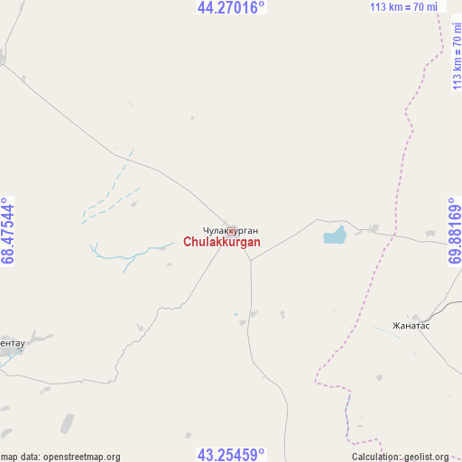
Chulakkurgan GPS coordinates[2]
43° 45' 52.308" North, 69° 10' 42.816" East
| Map corner | latitude | longitude |
|---|---|---|
| Upper-left | 44.27016°, | 68.47544° |
| Center: | 43.76453°, | 69.17856° |
| Lower-right: | 43.25459°, | 69.88169° |
| Map W x H: | 112.9×112.9 km | = 70.2×70.2mi |
| max Lat: | 54.90596° ⇑81.1% North |
| Chulakkurgan: | 43.76453° |
| min Lat: | ⇓18.9% South 40.66338° |
| min Long | Chulakkurgan | max Long |
| 46.83361° | 69.17856° | 84.87144° |
| W 42.2%⇐ | ⇒57.8% E |
Elevation
Elevation of Chulakkurgan is 472 m = 1549 ft, and this is 115.5 m = 379 ft above average elevation for this country.
| Max E: |
1847 m = 6060 ft | 29.6% |
| Chulakkurgan | 472 m 1549 ft | |
| Avg. | 356.5 m = 1170 ft | |
Min E: |
-26 m = -85 ft | 70.4% |
See also: Kazakhstan elevation on elevation.city.
Geographical zone
Chulakkurgan is located in North temperate zone (between Tropic of Cancer and the Arctic Circle). Distance of this Northern Tropic circle is 2260.2 km =1404.4 mi to South.| Distance of | km | miles | from Chulakkurgan |
|---|---|---|---|
| North Pole | 5140.9 | 3194.4 | to North |
| Arctic Circle | 2535 | 1575.2 | to North |
| Tropic Cancer | 2260.2 | 1404.4 | to South |
| Equator | 4866.2 | 3023.7 | to South |


Nearby cities:
15 places around Chulakkurgan: (largest is in red/bold)
• Arys
151.4 km =94.1 mi,  191°
191°
• Ashchysay
32.5 km =20.2 mi,  223°
223°
• Bayzhansay
89.1 km =55.4 mi,  138°
138°
• Chayan
82.9 km =51.5 mi,  168°
168°
• Kantagi
54.7 km =34 mi,  241°
241°
• Karatau
122.7 km =76.2 mi,  122°
122°
• Kentau
60.8 km =37.8 mi, 243°
• Qogham
127 km =78.9 mi,  214°
214°
• Sastobe
150.2 km =93.3 mi,  153°
153°
• Shalqīya
144.3 km =89.7 mi,  280°
280°
• Shyghanaq
135.4 km =84.1 mi,  28°
28°
• Temirlanovka
129.6 km =80.5 mi,  177°
177°
• Turkestan
91 km =56.5 mi, 235°
• Yanykurgan
155.8 km =96.8 mi, 275°
• Zhangatas
50 km =31.1 mi, 116°
Sources, notices
• [Note1] Compared only with cities in Kazakhstan existing in our database
• [Src1] Map data: © OpenStreetMap contributors (CC-BY-SA)
• [Src2] Other city data from geonames.org with taken over terms of usage.
• [Src3] Geographical zone / Annual Mean Temperature by Robert A. Rohde @ Wikipedia
