Kentau geodata
Kentau (South Kazakhstan) is a populated place; located in Kazakhstan in Asia/Almaty (GMT+5) time zone. With population of 57,408 people, there are 26 cities with bigger population in this country. Compared to other cities in Kazakhstan, 84.1% of cities are located further ↑North; 61.9% of cities are located further →East and 64.8% of cities have lower elevation than Kentau. Note1


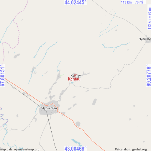
Kentau GPS coordinates[2]
43° 31' 0.192" North, 68° 30' 16.668" East
| Map corner | latitude | longitude |
|---|---|---|
| Upper-left | 44.02445°, | 67.80151° |
| Center: | 43.51672°, | 68.50463° |
| Lower-right: | 43.00468°, | 69.20776° |
| Map W x H: | 113.4×113.4 km | = 70.5×70.5mi |
| max Lat: | 54.90596° ⇑84.1% North |
| Kentau: | 43.51672° |
| min Lat: | ⇓15.9% South 40.66338° |
| min Long | Kentau | max Long |
| 46.83361° | 68.50463° | 84.87144° |
| W 38.1%⇐ | ⇒61.9% E |
Elevation
Elevation of Kentau is 426 m = 1398 ft, and this is 69.5 m = 228 ft above average elevation for this country.
| Max E: |
1847 m = 6060 ft | 35.2% |
| Kentau | 426 m 1398 ft | |
| Avg. | 356.5 m = 1170 ft | |
Min E: |
-26 m = -85 ft | 64.8% |
See also: Kentau elevation on elevation.city.
Geographical zone
Kentau is located in North temperate zone (between Tropic of Cancer and the Arctic Circle). Distance of this Northern Tropic circle is 2232.7 km =1387.3 mi to South.| Distance of | km | miles | from Kentau |
|---|---|---|---|
| North Pole | 5168.5 | 3211.6 | to North |
| Arctic Circle | 2562.6 | 1592.3 | to North |
| Tropic Cancer | 2232.7 | 1387.3 | to South |
| Equator | 4838.6 | 3006.6 | to South |


Nearby cities:
15 places around Kentau: (largest is in red/bold)
• Arys
123.3 km =76.6 mi,  168°
168°
• Ashchysay
32 km =19.9 mi,  82°
82°
• Bayzhansay
120.5 km =74.9 mi,  108°
108°
• Chayan
88.9 km =55.2 mi,  127°
127°
• Chulakkurgan
60.8 km =37.8 mi,  63°
63°
• Kantagi
6.4 km =4 mi, 78°
• Qogham
78.7 km =48.9 mi,  193°
193°
• Sastobe
161.9 km =100.6 mi, 131°
• Shalqīya
103.5 km =64.3 mi,  301°
301°
• Shymkent
162 km =100.7 mi,  146°
146°
• Shīeli
159.1 km =98.9 mi, 297°
• Temirlanovka
118.9 km =73.9 mi, 149°
• Turkestan
31.8 km =19.8 mi,  219°
219°
• Yanykurgan
110 km =68.4 mi,  293°
293°
• Zhangatas
99.2 km =61.6 mi,  87°
87°
Sources, notices
• [Note1] Compared only with cities in Kazakhstan existing in our database
• [Src1] Map data: © OpenStreetMap contributors (CC-BY-SA)
• [Src2] Other city data from geonames.org with taken over terms of usage.
• [Src3] Geographical zone / Annual Mean Temperature by Robert A. Rohde @ Wikipedia
