Taraz geodata
Taraz (Zhambyl) is a seat of a first-order administrative division; located in Kazakhstan in Asia/Almaty (GMT+5) time zone. With population of 358,153 people, there are 3 cities with bigger population in this country. Compared to other cities in Kazakhstan, 92.2% of cities are located further ↑North; 53.7% of cities are located further ←West and 84.1% of cities have lower elevation than Taraz. Note1


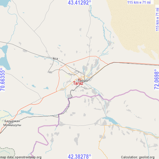
Taraz GPS coordinates[2]
42° 54' 0" North, 71° 22' 0.012" East
| Map corner | latitude | longitude |
|---|---|---|
| Upper-left | 43.41292°, | 70.66355° |
| Center: | 42.9°, | 71.36667° |
| Lower-right: | 42.38278°, | 72.0698° |
| Map W x H: | 114.5×114.5 km | = 71.1×71.1mi |
| max Lat: | 54.90596° ⇑92.2% North |
| Taraz: | 42.9° |
| min Lat: | ⇓7.8% South 40.66338° |
| min Long | Taraz | max Long |
| 46.83361° | 71.36667° | 84.87144° |
| W 53.7%⇐ | ⇒46.3% E |
Elevation
Elevation of Taraz is 623 m = 2044 ft, and this is 266.5 m = 874 ft above average elevation for this country.
| Max E: |
1847 m = 6060 ft | 15.9% |
| Taraz | 623 m 2044 ft | |
| Avg. | 356.5 m = 1170 ft | |
Min E: |
-26 m = -85 ft | 84.1% |
See also: Taraz elevation on elevation.city.
Geographical zone
Taraz is located in North temperate zone (between Tropic of Cancer and the Arctic Circle). Distance of this Northern Tropic circle is 2164.1 km =1344.7 mi to South.| Distance of | km | miles | from Taraz |
|---|---|---|---|
| North Pole | 5237 | 3254.1 | to North |
| Arctic Circle | 2631.1 | 1634.9 | to North |
| Tropic Cancer | 2164.1 | 1344.7 | to South |
| Equator | 4770 | 2963.9 | to South |


Nearby cities:
15 places around Taraz: (largest is in red/bold)
• Bayzhansay
121.7 km =75.6 mi,  284°
284°
• Belyye Vody
136.6 km =84.9 mi,  247°
247°
• Karatau
79.4 km =49.3 mi,  292°
292°
• Kokterek
101.4 km =63 mi,  243°
243°
• Lenger
145.3 km =90.3 mi, 236°
• Lugovoy
113.6 km =70.6 mi,  87°
87°
• Lugovoye
110.3 km =68.5 mi, 89°
• Merke
148.1 km =92 mi, 91°
• Sarykemer
15.5 km =9.6 mi,  44°
44°
• Sastobe
118.2 km =73.4 mi, 250°
• Sayram
147.5 km =91.7 mi, 243°
• Turar Ryskulov
92.5 km =57.5 mi, 243°
• Tyul’kubas
98.9 km =61.5 mi, 242°
• Zhabagly
89 km =55.3 mi,  234°
234°
• Zhangatas
151.4 km =94.1 mi,  299°
299°
Sources, notices
• [Note1] Compared only with cities in Kazakhstan existing in our database
• [Src1] Map data: © OpenStreetMap contributors (CC-BY-SA)
• [Src2] Other city data from geonames.org with taken over terms of usage.
• [Src3] Geographical zone / Annual Mean Temperature by Robert A. Rohde @ Wikipedia
