Lugovoy geodata
Lugovoy (Zhambyl) is a populated place; located in Kazakhstan in Asia/Almaty (GMT+5) time zone. With population of 10,422 people, there are 109 cities with bigger population in this country. Compared to other cities in Kazakhstan, 91.1% of cities are located further ↑North; 60.7% of cities are located further ←West and 88.9% of cities have lower elevation than Lugovoy. Note1


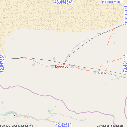
Lugovoy GPS coordinates[2]
42° 56' 31.092" North, 72° 45' 39.528" East
| Map corner | latitude | longitude |
|---|---|---|
| Upper-left | 43.45454°, | 72.05786° |
| Center: | 42.94197°, | 72.76098° |
| Lower-right: | 42.4251°, | 73.46411° |
| Map W x H: | 114.5×114.5 km | = 71.1×71.1mi |
| max Lat: | 54.90596° ⇑91.1% North |
| Lugovoy: | 42.94197° |
| min Lat: | ⇓8.9% South 40.66338° |
| min Long | Lugovoy | max Long |
| 46.83361° | 72.76098° | 84.87144° |
| W 60.7%⇐ | ⇒39.3% E |
Elevation
Elevation of Lugovoy is 687 m = 2254 ft, and this is 330.5 m = 1084 ft above average elevation for this country.
| Max E: |
1847 m = 6060 ft | 11.1% |
| Lugovoy | 687 m 2254 ft | |
| Avg. | 356.5 m = 1170 ft | |
Min E: |
-26 m = -85 ft | 88.9% |
See also: Kazakhstan elevation on elevation.city.
Geographical zone
Lugovoy is located in North temperate zone (between Tropic of Cancer and the Arctic Circle). Distance of this Northern Tropic circle is 2168.8 km =1347.6 mi to South.| Distance of | km | miles | from Lugovoy |
|---|---|---|---|
| North Pole | 5232.4 | 3251.3 | to North |
| Arctic Circle | 2626.5 | 1632 | to North |
| Tropic Cancer | 2168.8 | 1347.6 | to South |
| Equator | 4774.7 | 2966.9 | to South |


Nearby cities:
15 places around Lugovoy: (largest is in red/bold)
• Chu
109.3 km =67.9 mi,  47°
47°
• Georgiyevka
159.1 km =98.9 mi,  86°
86°
• Granitogorsk
61.7 km =38.3 mi,  110°
110°
• Karatau
188.1 km =116.9 mi,  278°
278°
• Khantaū
165.4 km =102.8 mi,  30°
30°
• Kokterek
210.7 km =130.9 mi,  256°
256°
• Lugovoye
4.8 km =3 mi,  222°
222°
• Merke
35.4 km =22 mi,  103°
103°
• Moyynkum
150 km =93.2 mi,  5°
5°
• Oytal
41.6 km =25.8 mi, 95°
• Sarykemer
102.8 km =63.9 mi,  273°
273°
• Taraz
113.6 km =70.6 mi, 267°
• Turar Ryskulov
202.1 km =125.6 mi, 257°
• Tyul’kubas
207.7 km =129.1 mi, 255°
• Zhabagly
194.8 km =121 mi,  253°
253°
Sources, notices
• [Note1] Compared only with cities in Kazakhstan existing in our database
• [Src1] Map data: © OpenStreetMap contributors (CC-BY-SA)
• [Src2] Other city data from geonames.org with taken over terms of usage.
• [Src3] Geographical zone / Annual Mean Temperature by Robert A. Rohde @ Wikipedia
