Troyebratskiy geodata
Troyebratskiy (Qostanay) is a populated place; located in Kazakhstan in Asia/Qostanay (GMT+5) time zone. With population of 2,951 people, there are 229 cities with bigger population in this country. Compared to other cities in Kazakhstan, 98.5% of cities are located further ↓South; 70.7% of cities are located further →East and 73.7% of cities have higher elevation than Troyebratskiy. Note1


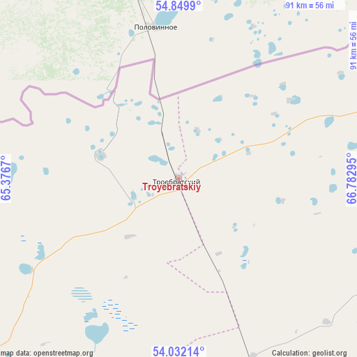
Troyebratskiy GPS coordinates[2]
54° 26' 35.016" North, 66° 4' 47.352" East
| Map corner | latitude | longitude |
|---|---|---|
| Upper-left | 54.8499°, | 65.3767° |
| Center: | 54.44306°, | 66.07982° |
| Lower-right: | 54.03214°, | 66.78295° |
| Map W x H: | 90.9×90.9 km | = 56.5×56.5mi |
| max Lat: | 54.90596° ⇑1.5% North |
| Troyebratskiy: | 54.44306° |
| min Lat: | ⇓98.5% South 40.66338° |
| min Long | Troyebratskiy | max Long |
| 46.83361° | 66.07982° | 84.87144° |
| W 29.3%⇐ | ⇒70.7% E |
Elevation
Elevation of Troyebratskiy is 161 m = 528 ft, and this is 195.5 m = 641 ft below average elevation for this country.
| Max E: |
1847 m = 6060 ft | 73.7% |
| Avg. | 356.5 m = 1170 ft | |
| Troyebratskiy | 161 m = 528 ft | |
Min E: |
-26 m = -85 ft | 26.3% |
See also: Kazakhstan elevation on elevation.city.
Geographical zone
Troyebratskiy is located in North temperate zone (between Tropic of Cancer and the Arctic Circle). Distance of this North polar circle is 1347.7 km =837.4 mi to North.| Distance of | km | miles | from Troyebratskiy |
|---|---|---|---|
| North Pole | 3953.6 | 2456.7 | to North |
| Arctic Circle | 1347.7 | 837.4 | to North |
| Tropic Cancer | 3447.6 | 2142.2 | to South |
| Equator | 6053.5 | 3761.5 | to South |


Nearby cities:
15 places around Troyebratskiy: (largest is in red/bold)
• Birlestik
176.6 km =109.7 mi,  122°
122°
• Bishkul
198 km =123 mi,  79°
79°
• Borovskoy
143.2 km =89 mi,  239°
239°
• Fyodorovka
238.3 km =148.1 mi,  247°
247°
• Karasu
202.1 km =125.6 mi,  191°
191°
• Kostanay
211.2 km =131.2 mi,  229°
229°
• Novoishimskiy
145.6 km =90.5 mi,  161°
161°
• Petropavl
203 km =126.1 mi, 76°
• Qusmuryn
241.7 km =150.2 mi,  203°
203°
• Sergeyevka
106.7 km =66.3 mi,  125°
125°
• Smirnovo
216.4 km =134.5 mi,  87°
87°
• Timiryazevo
81.6 km =50.7 mi, 160°
• Volodarskoye
184.4 km =114.6 mi, 133°
• Volodarskoye
201 km =124.9 mi,  170°
170°
• Yavlenka
154.3 km =95.9 mi, 94°
Sources, notices
• [Note1] Compared only with cities in Kazakhstan existing in our database
• [Src1] Map data: © OpenStreetMap contributors (CC-BY-SA)
• [Src2] Other city data from geonames.org with taken over terms of usage.
• [Src3] Geographical zone / Annual Mean Temperature by Robert A. Rohde @ Wikipedia
