Borovskoy geodata
Borovskoy (Qostanay) is a populated place; located in Kazakhstan in Asia/Qostanay (GMT+5) time zone. With population of 9,659 people, there are 123 cities with bigger population in this country. Compared to other cities in Kazakhstan, 97% of cities are located further ↓South; 73.7% of cities are located further →East and 70.4% of cities have higher elevation than Borovskoy. Note1


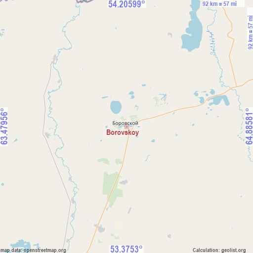
Borovskoy GPS coordinates[2]
53° 47' 33.72" North, 64° 10' 57.648" East
| Map corner | latitude | longitude |
|---|---|---|
| Upper-left | 54.20599°, | 63.47956° |
| Center: | 53.7927°, | 64.18268° |
| Lower-right: | 53.3753°, | 64.88581° |
| Map W x H: | 92.4×92.4 km | = 57.4×57.4mi |
| max Lat: | 54.90596° ⇑3% North |
| Borovskoy: | 53.7927° |
| min Lat: | ⇓97% South 40.66338° |
| min Long | Borovskoy | max Long |
| 46.83361° | 64.18268° | 84.87144° |
| W 26.3%⇐ | ⇒73.7% E |
Elevation
Elevation of Borovskoy is 175 m = 574 ft, and this is 181.5 m = 595 ft below average elevation for this country.
| Max E: |
1847 m = 6060 ft | 70.4% |
| Avg. | 356.5 m = 1170 ft | |
| Borovskoy | 175 m = 574 ft | |
Min E: |
-26 m = -85 ft | 29.6% |
See also: Kazakhstan elevation on elevation.city.
Geographical zone
Borovskoy is located in North temperate zone (between Tropic of Cancer and the Arctic Circle). Distance of this North polar circle is 1420 km =882.3 mi to North.| Distance of | km | miles | from Borovskoy |
|---|---|---|---|
| North Pole | 4025.9 | 2501.6 | to North |
| Arctic Circle | 1420 | 882.3 | to North |
| Tropic Cancer | 3375.3 | 2097.3 | to South |
| Equator | 5981.2 | 3716.5 | to South |


Nearby cities:
15 places around Borovskoy: (largest is in red/bold)
• Ayat
153.3 km =95.3 mi,  226°
226°
• Fyodorovka
99.3 km =61.7 mi,  260°
260°
• Karasu
152.9 km =95 mi,  145°
145°
• Komsomolets
139.7 km =86.8 mi,  268°
268°
• Kostanay
74.1 km =46 mi,  209°
209°
• Lisakovsk
178.2 km =110.7 mi,  218°
218°
• Novoishimskiy
183.4 km =114 mi,  111°
111°
• Qashar
98.8 km =61.4 mi,  241°
241°
• Qusmuryn
152 km =94.4 mi,  168°
168°
• Rudnyy
115.4 km =71.7 mi, 217°
• Sergeyevka
211.9 km =131.7 mi,  87°
87°
• Timiryazevo
151.6 km =94.2 mi, 91°
• Tobol
161.7 km =100.5 mi, 220°
• Troyebratskiy
143.2 km =89 mi,  59°
59°
• Volodarskoye
204.1 km =126.8 mi,  128°
128°
Sources, notices
• [Note1] Compared only with cities in Kazakhstan existing in our database
• [Src1] Map data: © OpenStreetMap contributors (CC-BY-SA)
• [Src2] Other city data from geonames.org with taken over terms of usage.
• [Src3] Geographical zone / Annual Mean Temperature by Robert A. Rohde @ Wikipedia
