Novoishimskiy geodata
Novoishimskiy (Soltüstik Qazaqstan) is a populated place; located in Kazakhstan in Asia/Almaty (GMT+5) time zone. With population of 6,062 people, there are 170 cities with bigger population in this country. Compared to other cities in Kazakhstan, 91.9% of cities are located further ↓South; 68.1% of cities are located further →East and 69.3% of cities have higher elevation than Novoishimskiy. Note1


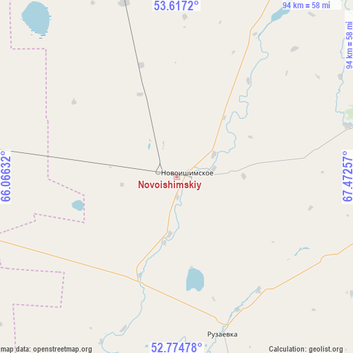
Novoishimskiy GPS coordinates[2]
53° 11' 53.016" North, 66° 46' 9.984" East
| Map corner | latitude | longitude |
|---|---|---|
| Upper-left | 53.6172°, | 66.06632° |
| Center: | 53.19806°, | 66.76944° |
| Lower-right: | 52.77478°, | 67.47257° |
| Map W x H: | 93.7×93.7 km | = 58.2×58.2mi |
| max Lat: | 54.90596° ⇑8.1% North |
| Novoishimskiy: | 53.19806° |
| min Lat: | ⇓91.9% South 40.66338° |
| min Long | Novoishimskiy | max Long |
| 46.83361° | 66.76944° | 84.87144° |
| W 31.9%⇐ | ⇒68.1% E |
Elevation
Elevation of Novoishimskiy is 184 m = 604 ft, and this is 172.5 m = 566 ft below average elevation for this country.
| Max E: |
1847 m = 6060 ft | 69.3% |
| Avg. | 356.5 m = 1170 ft | |
| Novoishimskiy | 184 m = 604 ft | |
Min E: |
-26 m = -85 ft | 30.7% |
See also: Kazakhstan elevation on elevation.city.
Geographical zone
Novoishimskiy is located in North temperate zone (between Tropic of Cancer and the Arctic Circle). Distance of this North polar circle is 1486.1 km =923.4 mi to North.| Distance of | km | miles | from Novoishimskiy |
|---|---|---|---|
| North Pole | 4092 | 2542.7 | to North |
| Arctic Circle | 1486.1 | 923.4 | to North |
| Tropic Cancer | 3309.2 | 2056.2 | to South |
| Equator | 5915.1 | 3675.5 | to South |


Nearby cities:
15 places around Novoishimskiy: (largest is in red/bold)
• Balkashino
153.1 km =95.1 mi,  119°
119°
• Birlestik
113.5 km =70.5 mi,  67°
67°
• Esil
140.4 km =87.2 mi,  190°
190°
• Karasu
104.9 km =65.2 mi,  235°
235°
• Kokshetau
175.3 km =108.9 mi,  86°
86°
• Krasnogorskiy
107.2 km =66.6 mi, 188°
• Qusmuryn
166.6 km =103.5 mi, 240°
• Sergeyevka
86.9 km =54 mi,  29°
29°
• Shantobe
125.5 km =78 mi,  131°
131°
• Timiryazevo
64.1 km =39.8 mi,  343°
343°
• Troyebratskiy
145.6 km =90.5 mi, 341°
• Volodarskoye
60.8 km =37.8 mi, 190°
• Volodarskoye
89.5 km =55.6 mi,  83°
83°
• Yavlenka
169 km =105 mi,  41°
41°
• Zhaqsy
147.9 km =91.9 mi,  165°
165°
Sources, notices
• [Note1] Compared only with cities in Kazakhstan existing in our database
• [Src1] Map data: © OpenStreetMap contributors (CC-BY-SA)
• [Src2] Other city data from geonames.org with taken over terms of usage.
• [Src3] Geographical zone / Annual Mean Temperature by Robert A. Rohde @ Wikipedia
