Timiryazevo geodata
Timiryazevo (Soltüstik Qazaqstan) is a populated place; located in Kazakhstan in Asia/Almaty (GMT+5) time zone. With population of 4,147 people, there are 208 cities with bigger population in this country. Compared to other cities in Kazakhstan, 96.3% of cities are located further ↓South; 69.6% of cities are located further →East and 71.1% of cities have higher elevation than Timiryazevo. Note1


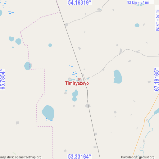
Timiryazevo GPS coordinates[2]
53° 44' 58.092" North, 66° 29' 18.672" East
| Map corner | latitude | longitude |
|---|---|---|
| Upper-left | 54.16319°, | 65.7854° |
| Center: | 53.74947°, | 66.48852° |
| Lower-right: | 53.33164°, | 67.19165° |
| Map W x H: | 92.5×92.5 km | = 57.5×57.5mi |
| max Lat: | 54.90596° ⇑3.7% North |
| Timiryazevo: | 53.74947° |
| min Lat: | ⇓96.3% South 40.66338° |
| min Long | Timiryazevo | max Long |
| 46.83361° | 66.48852° | 84.87144° |
| W 30.4%⇐ | ⇒69.6% E |
Elevation
Elevation of Timiryazevo is 170 m = 558 ft, and this is 186.5 m = 612 ft below average elevation for this country.
| Max E: |
1847 m = 6060 ft | 71.1% |
| Avg. | 356.5 m = 1170 ft | |
| Timiryazevo | 170 m = 558 ft | |
Min E: |
-26 m = -85 ft | 28.9% |
See also: Kazakhstan elevation on elevation.city.
Geographical zone
Timiryazevo is located in North temperate zone (between Tropic of Cancer and the Arctic Circle). Distance of this North polar circle is 1424.8 km =885.3 mi to North.| Distance of | km | miles | from Timiryazevo |
|---|---|---|---|
| North Pole | 4030.7 | 2504.6 | to North |
| Arctic Circle | 1424.8 | 885.3 | to North |
| Tropic Cancer | 3370.5 | 2094.3 | to South |
| Equator | 5976.4 | 3713.6 | to South |


Nearby cities:
15 places around Timiryazevo: (largest is in red/bold)
• Birlestik
124.2 km =77.2 mi,  98°
98°
• Borovskoy
151.6 km =94.2 mi,  271°
271°
• Esil
199.6 km =124 mi,  181°
181°
• Karasu
138.4 km =86 mi,  208°
208°
• Kokshetau
199.3 km =123.8 mi,  105°
105°
• Kostanay
198.6 km =123.4 mi,  252°
252°
• Krasnogorskiy
167.2 km =103.9 mi, 179°
• Novoishimskiy
64.1 km =39.8 mi,  163°
163°
• Qusmuryn
190.8 km =118.6 mi,  220°
220°
• Sergeyevka
62.2 km =38.6 mi,  76°
76°
• Shantobe
182.8 km =113.6 mi,  142°
142°
• Troyebratskiy
81.6 km =50.7 mi,  340°
340°
• Volodarskoye
118.3 km =73.5 mi,  115°
115°
• Volodarskoye
121.2 km =75.3 mi, 176°
• Yavlenka
144.6 km =89.9 mi,  62°
62°
Sources, notices
• [Note1] Compared only with cities in Kazakhstan existing in our database
• [Src1] Map data: © OpenStreetMap contributors (CC-BY-SA)
• [Src2] Other city data from geonames.org with taken over terms of usage.
• [Src3] Geographical zone / Annual Mean Temperature by Robert A. Rohde @ Wikipedia
