Yavlenka geodata
Yavlenka (Soltüstik Qazaqstan) is a populated place; located in Kazakhstan in Asia/Almaty (GMT+5) time zone. With population of 4,945 people, there are 194 cities with bigger population in this country. Compared to other cities in Kazakhstan, 98.1% of cities are located further ↓South; 62.2% of cities are located further →East and 77% of cities have higher elevation than Yavlenka. Note1


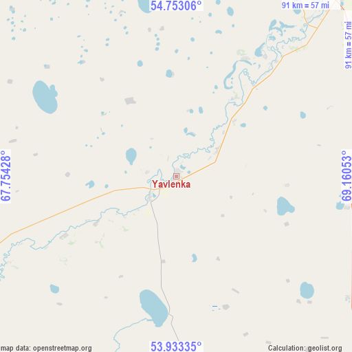
Yavlenka GPS coordinates[2]
54° 20' 42.9" North, 68° 27' 26.64" East
| Map corner | latitude | longitude |
|---|---|---|
| Upper-left | 54.75306°, | 67.75428° |
| Center: | 54.34525°, | 68.4574° |
| Lower-right: | 53.93335°, | 69.16053° |
| Map W x H: | 91.1×91.1 km | = 56.6×56.6mi |
| max Lat: | 54.90596° ⇑1.9% North |
| Yavlenka: | 54.34525° |
| min Lat: | ⇓98.1% South 40.66338° |
| min Long | Yavlenka | max Long |
| 46.83361° | 68.4574° | 84.87144° |
| W 37.8%⇐ | ⇒62.2% E |
Elevation
Elevation of Yavlenka is 132 m = 433 ft, and this is 224.5 m = 737 ft below average elevation for this country.
| Max E: |
1847 m = 6060 ft | 77% |
| Avg. | 356.5 m = 1170 ft | |
| Yavlenka | 132 m = 433 ft | |
Min E: |
-26 m = -85 ft | 23% |
See also: Kazakhstan elevation on elevation.city.
Geographical zone
Yavlenka is located in North temperate zone (between Tropic of Cancer and the Arctic Circle). Distance of this North polar circle is 1358.5 km =844.1 mi to North.| Distance of | km | miles | from Yavlenka |
|---|---|---|---|
| North Pole | 3964.4 | 2463.4 | to North |
| Arctic Circle | 1358.5 | 844.1 | to North |
| Tropic Cancer | 3436.7 | 2135.5 | to South |
| Equator | 6042.6 | 3754.7 | to South |


Nearby cities:
15 places around Yavlenka: (largest is in red/bold)
• Akkol’
138.7 km =86.2 mi,  147°
147°
• Birlestik
84.9 km =52.8 mi,  184°
184°
• Bishkul
63.4 km =39.4 mi,  40°
40°
• Bulayevo
142.1 km =88.3 mi,  63°
63°
• Būrabay
186 km =115.6 mi,  138°
138°
• Kokshetau
133.3 km =82.8 mi, 152°
• Novoishimskiy
169 km =105 mi,  221°
221°
• Petropavl
73.1 km =45.4 mi, 37°
• Sergeyevka
85.6 km =53.2 mi,  232°
232°
• Shchuchinsk
193.9 km =120.5 mi, 143°
• Smirnovo
65.5 km =40.7 mi,  73°
73°
• Taiynsha
101.8 km =63.3 mi,  122°
122°
• Timiryazevo
144.6 km =89.9 mi,  242°
242°
• Troyebratskiy
154.3 km =95.9 mi,  274°
274°
• Volodarskoye
119.3 km =74.1 mi,  191°
191°
Sources, notices
• [Note1] Compared only with cities in Kazakhstan existing in our database
• [Src1] Map data: © OpenStreetMap contributors (CC-BY-SA)
• [Src2] Other city data from geonames.org with taken over terms of usage.
• [Src3] Geographical zone / Annual Mean Temperature by Robert A. Rohde @ Wikipedia
