Fyodorovka geodata
Fyodorovka (Qostanay) is a populated place; located in Kazakhstan in Asia/Qostanay (GMT+5) time zone. With population of 8,317 people, there are 141 cities with bigger population in this country. Compared to other cities in Kazakhstan, 95.9% of cities are located further ↓South; 76.7% of cities are located further →East and 67% of cities have higher elevation than Fyodorovka. Note1


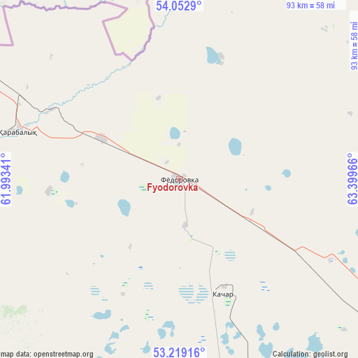
Fyodorovka GPS coordinates[2]
53° 38' 17.124" North, 62° 41' 47.508" East
| Map corner | latitude | longitude |
|---|---|---|
| Upper-left | 54.0529°, | 61.99341° |
| Center: | 53.63809°, | 62.69653° |
| Lower-right: | 53.21916°, | 63.39966° |
| Map W x H: | 92.7×92.7 km | = 57.6×57.6mi |
| max Lat: | 54.90596° ⇑4.1% North |
| Fyodorovka: | 53.63809° |
| min Lat: | ⇓95.9% South 40.66338° |
| min Long | Fyodorovka | max Long |
| 46.83361° | 62.69653° | 84.87144° |
| W 23.3%⇐ | ⇒76.7% E |
Elevation
Elevation of Fyodorovka is 196 m = 643 ft, and this is 160.5 m = 527 ft below average elevation for this country.
| Max E: |
1847 m = 6060 ft | 67% |
| Avg. | 356.5 m = 1170 ft | |
| Fyodorovka | 196 m = 643 ft | |
Min E: |
-26 m = -85 ft | 33% |
See also: Kazakhstan elevation on elevation.city.
Geographical zone
Fyodorovka is located in North temperate zone (between Tropic of Cancer and the Arctic Circle). Distance of this North polar circle is 1437.2 km =893 mi to North.| Distance of | km | miles | from Fyodorovka |
|---|---|---|---|
| North Pole | 4043.1 | 2512.3 | to North |
| Arctic Circle | 1437.2 | 893 | to North |
| Tropic Cancer | 3358.1 | 2086.6 | to South |
| Equator | 5964 | 3705.9 | to South |


Nearby cities:
14 places around Fyodorovka: (largest is in red/bold)
• Ayat
90 km =55.9 mi,  187°
187°
• Borovskoy
99.3 km =61.7 mi,  80°
80°
• Dzhetygara
189.7 km =117.9 mi,  211°
211°
• Karasu
215.4 km =133.8 mi,  120°
120°
• Komsomolets
43.8 km =27.2 mi,  286°
286°
• Kostanay
77.5 km =48.2 mi,  127°
127°
• Lisakovsk
122 km =75.8 mi, 186°
• Ordzhonikidze
146.7 km =91.2 mi, 205°
• Qashar
32.1 km =19.9 mi,  159°
159°
• Qusmuryn
184.2 km =114.5 mi,  135°
135°
• Rudnyy
79.1 km =49.2 mi, 159°
• Timiryazevo
249.9 km =155.3 mi,  87°
87°
• Tobol
105.2 km =65.4 mi,  183°
183°
• Troyebratskiy
238.3 km =148.1 mi,  67°
67°
Sources, notices
• [Note1] Compared only with cities in Kazakhstan existing in our database
• [Src1] Map data: © OpenStreetMap contributors (CC-BY-SA)
• [Src2] Other city data from geonames.org with taken over terms of usage.
• [Src3] Geographical zone / Annual Mean Temperature by Robert A. Rohde @ Wikipedia
