Qusmuryn geodata
Qusmuryn (Qostanay) is a populated place; located in Kazakhstan in Asia/Qostanay (GMT+5) time zone. With population of 8,049 people, there are 144 cities with bigger population in this country. Compared to other cities in Kazakhstan, 85.9% of cities are located further ↓South; 73.3% of cities are located further →East and 80.7% of cities have higher elevation than Qusmuryn. Note1


Qusmuryn GPS coordinates[2]
52° 27' 3.852" North, 64° 37' 11.172" East
| Map corner | latitude | longitude |
|---|---|---|
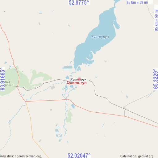
| Upper-left | 52.8775°, | 63.91665° |
| Center: | 52.45107°, | 64.61977° |
| Lower-right: | 52.02047°, | 65.3229° |
| Map W x H: | 95.3×95.3 km | = 59.2×59.2mi |
| max Lat: | 54.90596° ⇑14.1% North |
| Qusmuryn: | 52.45107° |
| min Lat: | ⇓85.9% South 40.66338° |
| min Long | Qusmuryn | max Long |
| 46.83361° | 64.61977° | 84.87144° |
| W 26.7%⇐ | ⇒73.3% E |
Elevation
Elevation of Qusmuryn is 114 m = 374 ft, and this is 242.5 m = 796 ft below average elevation for this country.
| Max E: |
1847 m = 6060 ft | 80.7% |
| Avg. | 356.5 m = 1170 ft | |
| Qusmuryn | 114 m = 374 ft | |
Min E: |
-26 m = -85 ft | 19.3% |
See also: Kazakhstan elevation on elevation.city.
Geographical zone
Qusmuryn is located in North temperate zone (between Tropic of Cancer and the Arctic Circle). Distance of this North polar circle is 1569.2 km =975.1 mi to North.| Distance of | km | miles | from Qusmuryn |
|---|---|---|---|
| North Pole | 4175 | 2594.2 | to North |
| Arctic Circle | 1569.2 | 975.1 | to North |
| Tropic Cancer | 3226.1 | 2004.6 | to South |
| Equator | 5832 | 3623.8 | to South |


Nearby cities:
15 places around Qusmuryn: (largest is in red/bold)
• Ayat
147.9 km =91.9 mi,  286°
286°
• Borovskoy
152 km =94.4 mi,  348°
348°
• Derzhavīnsk
190.3 km =118.2 mi,  142°
142°
• Esil
133.8 km =83.1 mi,  114°
114°
• Fyodorovka
184.2 km =114.5 mi,  315°
315°
• Karasu
62.9 km =39.1 mi,  68°
68°
• Kostanay
108 km =67.1 mi, 321°
• Krasnogorskiy
131.1 km =81.5 mi,  100°
100°
• Lisakovsk
143.9 km =89.4 mi,  274°
274°
• Novoishimskiy
166.6 km =103.5 mi,  60°
60°
• Qashar
155.5 km =96.6 mi,  310°
310°
• Rudnyy
116.7 km =72.5 mi,  299°
299°
• Timiryazevo
190.8 km =118.6 mi,  40°
40°
• Tobol
139.7 km =86.8 mi,  281°
281°
• Volodarskoye
135.7 km =84.3 mi,  80°
80°
Sources, notices
• [Note1] Compared only with cities in Kazakhstan existing in our database
• [Src1] Map data: © OpenStreetMap contributors (CC-BY-SA)
• [Src2] Other city data from geonames.org with taken over terms of usage.
• [Src3] Geographical zone / Annual Mean Temperature by Robert A. Rohde @ Wikipedia
