Sergeyevka geodata
Sergeyevka (Soltüstik Qazaqstan) is a populated place; located in Kazakhstan in Asia/Almaty (GMT+5) time zone. With population of 8,845 people, there are 135 cities with bigger population in this country. Compared to other cities in Kazakhstan, 97.8% of cities are located further ↓South; 66.7% of cities are located further →East and 74.8% of cities have higher elevation than Sergeyevka. Note1


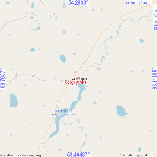
Sergeyevka GPS coordinates[2]
53° 52' 53.004" North, 67° 24' 31.752" East
| Map corner | latitude | longitude |
|---|---|---|
| Upper-left | 54.2938°, | 66.7057° |
| Center: | 53.88139°, | 67.40882° |
| Lower-right: | 53.46487°, | 68.11195° |
| Map W x H: | 92.2×92.2 km | = 57.3×57.3mi |
| max Lat: | 54.90596° ⇑2.2% North |
| Sergeyevka: | 53.88139° |
| min Lat: | ⇓97.8% South 40.66338° |
| min Long | Sergeyevka | max Long |
| 46.83361° | 67.40882° | 84.87144° |
| W 33.3%⇐ | ⇒66.7% E |
Elevation
Elevation of Sergeyevka is 149 m = 489 ft, and this is 207.5 m = 681 ft below average elevation for this country.
| Max E: |
1847 m = 6060 ft | 74.8% |
| Avg. | 356.5 m = 1170 ft | |
| Sergeyevka | 149 m = 489 ft | |
Min E: |
-26 m = -85 ft | 25.2% |
See also: Kazakhstan elevation on elevation.city.
Geographical zone
Sergeyevka is located in North temperate zone (between Tropic of Cancer and the Arctic Circle). Distance of this North polar circle is 1410.1 km =876.2 mi to North.| Distance of | km | miles | from Sergeyevka |
|---|---|---|---|
| North Pole | 4016 | 2495.4 | to North |
| Arctic Circle | 1410.1 | 876.2 | to North |
| Tropic Cancer | 3385.1 | 2103.4 | to South |
| Equator | 5991 | 3722.6 | to South |


Nearby cities:
15 places around Sergeyevka: (largest is in red/bold)
• Akkol’
158.6 km =98.5 mi,  114°
114°
• Balkashino
176 km =109.4 mi,  149°
149°
• Birlestik
70.4 km =43.7 mi,  118°
118°
• Bishkul
148.1 km =92 mi,  47°
47°
• Kokshetau
147.3 km =91.5 mi, 116°
• Novoishimskiy
86.9 km =54 mi,  209°
209°
• Petropavl
157.2 km =97.7 mi, 45°
• Shantobe
166.7 km =103.6 mi,  162°
162°
• Smirnovo
149 km =92.6 mi,  61°
61°
• Taiynsha
154.7 km =96.1 mi,  91°
91°
• Timiryazevo
62.2 km =38.6 mi,  256°
256°
• Troyebratskiy
106.7 km =66.3 mi,  305°
305°
• Volodarskoye
80 km =49.7 mi,  144°
144°
• Volodarskoye
146 km =90.7 mi,  201°
201°
• Yavlenka
85.6 km =53.2 mi, 52°
Sources, notices
• [Note1] Compared only with cities in Kazakhstan existing in our database
• [Src1] Map data: © OpenStreetMap contributors (CC-BY-SA)
• [Src2] Other city data from geonames.org with taken over terms of usage.
• [Src3] Geographical zone / Annual Mean Temperature by Robert A. Rohde @ Wikipedia
