Volodarskoye geodata
Volodarskoye (Soltüstik Qazaqstan) is a populated place; located in Kazakhstan in Asia/Almaty (GMT+5) time zone. With population of 2,074 people, there are 243 cities with bigger population in this country. Compared to other cities in Kazakhstan, 93% of cities are located further ↓South; 65.2% of cities are located further →East and 52.6% of cities have higher elevation than Volodarskoye. Note1


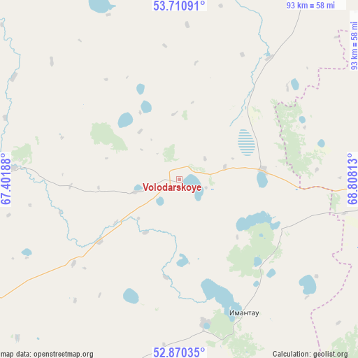
Volodarskoye GPS coordinates[2]
53° 17' 33.72" North, 68° 6' 18" East
| Map corner | latitude | longitude |
|---|---|---|
| Upper-left | 53.71091°, | 67.40188° |
| Center: | 53.2927°, | 68.105° |
| Lower-right: | 52.87035°, | 68.80813° |
| Map W x H: | 93.5×93.5 km | = 58.1×58.1mi |
| max Lat: | 54.90596° ⇑7% North |
| Volodarskoye: | 53.2927° |
| min Lat: | ⇓93% South 40.66338° |
| min Long | Volodarskoye | max Long |
| 46.83361° | 68.105° | 84.87144° |
| W 34.8%⇐ | ⇒65.2% E |
Elevation
Elevation of Volodarskoye is 297 m = 974 ft, and this is 59.5 m = 195 ft below average elevation for this country.
| Max E: |
1847 m = 6060 ft | 52.6% |
| Avg. | 356.5 m = 1170 ft | |
| Volodarskoye | 297 m = 974 ft | |
Min E: |
-26 m = -85 ft | 47.4% |
See also: Kazakhstan elevation on elevation.city.
Geographical zone
Volodarskoye is located in North temperate zone (between Tropic of Cancer and the Arctic Circle). Distance of this North polar circle is 1475.6 km =916.9 mi to North.| Distance of | km | miles | from Volodarskoye |
|---|---|---|---|
| North Pole | 4081.5 | 2536.1 | to North |
| Arctic Circle | 1475.6 | 916.9 | to North |
| Tropic Cancer | 3319.7 | 2062.8 | to South |
| Equator | 5925.6 | 3682 | to South |


Nearby cities:
15 places around Volodarskoye: (largest is in red/bold)
• Akkol’
99.4 km =61.8 mi,  89°
89°
• Balkashino
96.5 km =60 mi,  153°
153°
• Birlestik
36.4 km =22.6 mi,  26°
26°
• Būrabay
149 km =92.6 mi,  98°
98°
• Kokshetau
86.1 km =53.5 mi, 90°
• Krasnogorskiy
157.8 km =98.1 mi,  222°
222°
• Novoishimskiy
89.5 km =55.6 mi,  263°
263°
• Sergeyevka
80 km =49.7 mi,  324°
324°
• Shantobe
93.4 km =58 mi,  177°
177°
• Shchuchinsk
144.6 km =89.9 mi,  105°
105°
• Smirnovo
161.1 km =100.1 mi, 32°
• Taiynsha
126 km =78.3 mi,  60°
60°
• Timiryazevo
118.3 km =73.5 mi,  295°
295°
• Volodarskoye
123 km =76.4 mi,  235°
235°
• Yavlenka
119.3 km =74.1 mi,  11°
11°
Sources, notices
• [Note1] Compared only with cities in Kazakhstan existing in our database
• [Src1] Map data: © OpenStreetMap contributors (CC-BY-SA)
• [Src2] Other city data from geonames.org with taken over terms of usage.
• [Src3] Geographical zone / Annual Mean Temperature by Robert A. Rohde @ Wikipedia
