Bulayevo geodata
Bulayevo (Soltüstik Qazaqstan) is a populated place; located in Kazakhstan in Asia/Almaty (GMT+5) time zone. With population of 9,886 people, there are 116 cities with bigger population in this country. Compared to other cities in Kazakhstan, 100% of cities are located further ↓South; 51.1% of cities are located further ←West and 77.8% of cities have higher elevation than Bulayevo. Note1


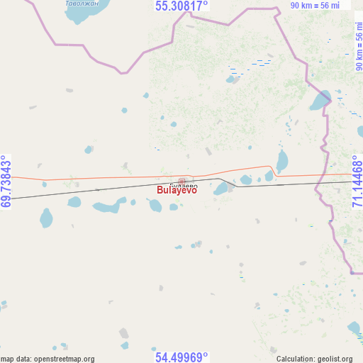
Bulayevo GPS coordinates[2]
54° 54' 21.456" North, 70° 26' 29.58" East
| Map corner | latitude | longitude |
|---|---|---|
| Upper-left | 55.30817°, | 69.73843° |
| Center: | 54.90596°, | 70.44155° |
| Lower-right: | 54.49969°, | 71.14468° |
| Map W x H: | 89.9×89.9 km | = 55.9×55.9mi |
| max Lat: | 54.90596° ⇑0% North |
| Bulayevo: | 54.90596° |
| min Lat: | ⇓100% South 40.66338° |
| min Long | Bulayevo | max Long |
| 46.83361° | 70.44155° | 84.87144° |
| W 51.1%⇐ | ⇒48.9% E |
Elevation
Elevation of Bulayevo is 130 m = 427 ft, and this is 226.5 m = 743 ft below average elevation for this country.
| Max E: |
1847 m = 6060 ft | 77.8% |
| Avg. | 356.5 m = 1170 ft | |
| Bulayevo | 130 m = 427 ft | |
Min E: |
-26 m = -85 ft | 22.2% |
See also: Kazakhstan elevation on elevation.city.
Geographical zone
Bulayevo is located in North temperate zone (between Tropic of Cancer and the Arctic Circle). Distance of this North polar circle is 1296.2 km =805.4 mi to North.| Distance of | km | miles | from Bulayevo |
|---|---|---|---|
| North Pole | 3902.1 | 2424.7 | to North |
| Arctic Circle | 1296.2 | 805.4 | to North |
| Tropic Cancer | 3499.1 | 2174.2 | to South |
| Equator | 6105 | 3793.5 | to South |


Nearby cities:
15 places around Bulayevo: (largest is in red/bold)
• Akkol’
187.2 km =116.3 mi,  197°
197°
• Birlestik
200 km =124.3 mi,  222°
222°
• Bishkul
87.1 km =54.1 mi,  260°
260°
• Būrabay
202.8 km =126 mi,  182°
182°
• Kokshetau
192.8 km =119.8 mi, 200°
• Kzyltu
187.5 km =116.5 mi,  138°
138°
• Petropavl
82.7 km =51.4 mi,  266°
266°
• Sergeyevka
227 km =141.1 mi,  239°
239°
• Shchuchinsk
219.7 km =136.5 mi, 184°
• Smirnovo
78.3 km =48.7 mi, 236°
• Stepnyak
231.4 km =143.8 mi,  174°
174°
• Taiynsha
125.5 km =78 mi, 200°
• Talshik
169 km =105 mi,  146°
146°
• Volodarskoye
235.3 km =146.2 mi, 220°
• Yavlenka
142.1 km =88.3 mi, 243°
Sources, notices
• [Note1] Compared only with cities in Kazakhstan existing in our database
• [Src1] Map data: © OpenStreetMap contributors (CC-BY-SA)
• [Src2] Other city data from geonames.org with taken over terms of usage.
• [Src3] Geographical zone / Annual Mean Temperature by Robert A. Rohde @ Wikipedia
