Stepnyak geodata
Stepnyak (Aqmola) is a populated place; located in Kazakhstan in Asia/Almaty (GMT+5) time zone. With population of 4,928 people, there are 195 cities with bigger population in this country. Compared to other cities in Kazakhstan, 89.6% of cities are located further ↓South; 52.2% of cities are located further ←West and 55.9% of cities have lower elevation than Stepnyak. Note1


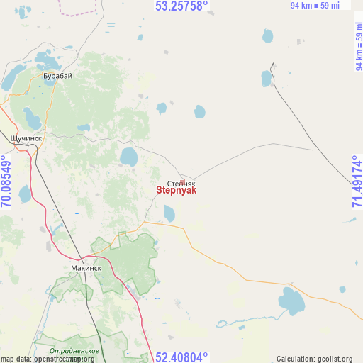
Stepnyak GPS coordinates[2]
52° 50' 5.604" North, 70° 47' 18.996" East
| Map corner | latitude | longitude |
|---|---|---|
| Upper-left | 53.25758°, | 70.08549° |
| Center: | 52.83489°, | 70.78861° |
| Lower-right: | 52.40804°, | 71.49174° |
| Map W x H: | 94.5×94.5 km | = 58.7×58.7mi |
| max Lat: | 54.90596° ⇑10.4% North |
| Stepnyak: | 52.83489° |
| min Lat: | ⇓89.6% South 40.66338° |
| min Long | Stepnyak | max Long |
| 46.83361° | 70.78861° | 84.87144° |
| W 52.2%⇐ | ⇒47.8% E |
Elevation
Elevation of Stepnyak is 366 m = 1201 ft, and this is 9.5 m = 31 ft above average elevation for this country.
| Max E: |
1847 m = 6060 ft | 44.1% |
| Stepnyak | 366 m 1201 ft | |
| Avg. | 356.5 m = 1170 ft | |
Min E: |
-26 m = -85 ft | 55.9% |
See also: Kazakhstan elevation on elevation.city.
Geographical zone
Stepnyak is located in North temperate zone (between Tropic of Cancer and the Arctic Circle). Distance of this North polar circle is 1526.5 km =948.5 mi to North.| Distance of | km | miles | from Stepnyak |
|---|---|---|---|
| North Pole | 4132.4 | 2567.8 | to North |
| Arctic Circle | 1526.5 | 948.5 | to North |
| Tropic Cancer | 3268.8 | 2031.1 | to South |
| Equator | 5874.7 | 3650.4 | to South |


Nearby cities:
15 places around Stepnyak: (largest is in red/bold)
• Akkol
94.1 km =58.5 mi,  173°
173°
• Akkol’
94.5 km =58.7 mi,  302°
302°
• Aksu
90 km =55.9 mi,  118°
118°
• Balkashino
141.8 km =88.1 mi,  255°
255°
• Būrabay
42.2 km =26.2 mi,  311°
311°
• Kokshetau
105.3 km =65.4 mi, 298°
• Kzyltu
136.4 km =84.8 mi,  49°
49°
• Makinsk
33.5 km =20.8 mi,  227°
227°
• Shchuchinsk
41.8 km =26 mi,  285°
285°
• Shortandy
127 km =78.9 mi, 173°
• Stepnogorsk
91.4 km =56.8 mi,  126°
126°
• Taiynsha
131.5 km =81.7 mi,  328°
328°
• Talshik
114.8 km =71.3 mi,  38°
38°
• Zavodskoy
92.1 km =57.2 mi, 116°
• Zholymbet
136.8 km =85 mi,  152°
152°
Sources, notices
• [Note1] Compared only with cities in Kazakhstan existing in our database
• [Src1] Map data: © OpenStreetMap contributors (CC-BY-SA)
• [Src2] Other city data from geonames.org with taken over terms of usage.
• [Src3] Geographical zone / Annual Mean Temperature by Robert A. Rohde @ Wikipedia
