Taiynsha geodata
Taiynsha (Soltüstik Qazaqstan) is a populated place; located in Kazakhstan in Asia/Almaty (GMT+5) time zone. With population of 13,148 people, there are 93 cities with bigger population in this country. Compared to other cities in Kazakhstan, 97.4% of cities are located further ↓South; 53.7% of cities are located further →East and 74.1% of cities have higher elevation than Taiynsha. Note1


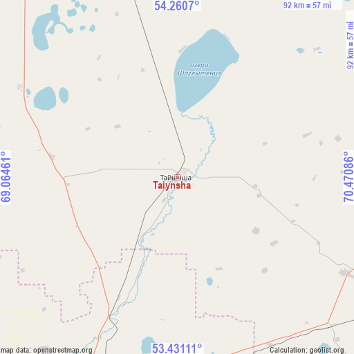
Taiynsha GPS coordinates[2]
53° 50' 52.656" North, 69° 46' 3.828" East
| Map corner | latitude | longitude |
|---|---|---|
| Upper-left | 54.2607°, | 69.06461° |
| Center: | 53.84796°, | 69.76773° |
| Lower-right: | 53.43111°, | 70.47086° |
| Map W x H: | 92.2×92.2 km | = 57.3×57.3mi |
| max Lat: | 54.90596° ⇑2.6% North |
| Taiynsha: | 53.84796° |
| min Lat: | ⇓97.4% South 40.66338° |
| min Long | Taiynsha | max Long |
| 46.83361° | 69.76773° | 84.87144° |
| W 46.3%⇐ | ⇒53.7% E |
Elevation
Elevation of Taiynsha is 155 m = 509 ft, and this is 201.5 m = 661 ft below average elevation for this country.
| Max E: |
1847 m = 6060 ft | 74.1% |
| Avg. | 356.5 m = 1170 ft | |
| Taiynsha | 155 m = 509 ft | |
Min E: |
-26 m = -85 ft | 25.9% |
See also: Kazakhstan elevation on elevation.city.
Geographical zone
Taiynsha is located in North temperate zone (between Tropic of Cancer and the Arctic Circle). Distance of this North polar circle is 1413.8 km =878.5 mi to North.| Distance of | km | miles | from Taiynsha |
|---|---|---|---|
| North Pole | 4019.7 | 2497.7 | to North |
| Arctic Circle | 1413.8 | 878.5 | to North |
| Tropic Cancer | 3381.4 | 2101.1 | to South |
| Equator | 5987.3 | 3720.3 | to South |


Nearby cities:
15 places around Taiynsha: (largest is in red/bold)
• Akkol’
62.3 km =38.7 mi,  190°
190°
• Birlestik
97.5 km =60.6 mi,  252°
252°
• Bishkul
112.1 km =69.7 mi,  337°
337°
• Bulayevo
125.5 km =78 mi,  20°
20°
• Būrabay
92.3 km =57.4 mi,  156°
156°
• Kokshetau
67.3 km =41.8 mi,  201°
201°
• Makinsk
141.9 km =88.2 mi, 162°
• Petropavl
120.1 km =74.6 mi, 340°
• Sergeyevka
154.7 km =96.1 mi,  271°
271°
• Shchuchinsk
105.2 km =65.4 mi, 164°
• Smirnovo
77.4 km =48.1 mi, 343°
• Stepnyak
131.5 km =81.7 mi,  148°
148°
• Talshik
140.5 km =87.3 mi,  99°
99°
• Volodarskoye
126 km =78.3 mi,  240°
240°
• Yavlenka
101.8 km =63.3 mi,  302°
302°
Sources, notices
• [Note1] Compared only with cities in Kazakhstan existing in our database
• [Src1] Map data: © OpenStreetMap contributors (CC-BY-SA)
• [Src2] Other city data from geonames.org with taken over terms of usage.
• [Src3] Geographical zone / Annual Mean Temperature by Robert A. Rohde @ Wikipedia
